[2019.12.02 10 PM] NWS Boston EM Briefing: Weather Hazards Thru Early Tuesday

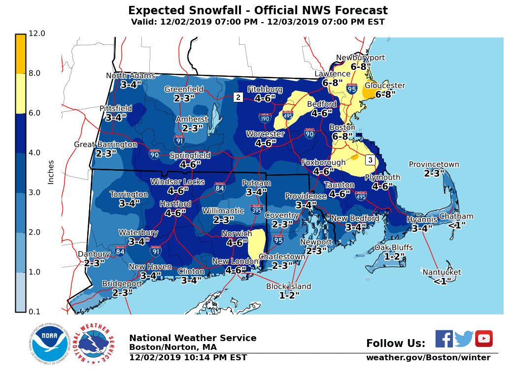
Good evening everyone, Just a quick update... No changes to warnings. We have lowered expected snowfall totals just a tad based on some of the latest model information. Still have high confidence of 4 inches in eastern MA with areas of 6 to 8 inches possible. A slight shift to the west of the track of the storm could mean higher totals and a slight shift more offshore would mean lower totals. During the past two hours, four inches have fallen in a very heavy band over Windsor Locks, CT. The potential for similar banding exists toward daybreak in eastern MA. If a heavy band were to occur there, it would most likely be between 4 AM and 10 AM. Please see attached snow total graphic, from 7 PM this evening to 7 PM tomorrow evening. -- Glenn Field Warning Coordination Meteorologist NWS - Boston/Norton, MA
participants (1)
-
 Glenn Field - NOAA Federal