[06.09.21 AM] NWS Boston EM Briefing - Final Day of Oppressive Heat, Scattered Strong Thunderstorms

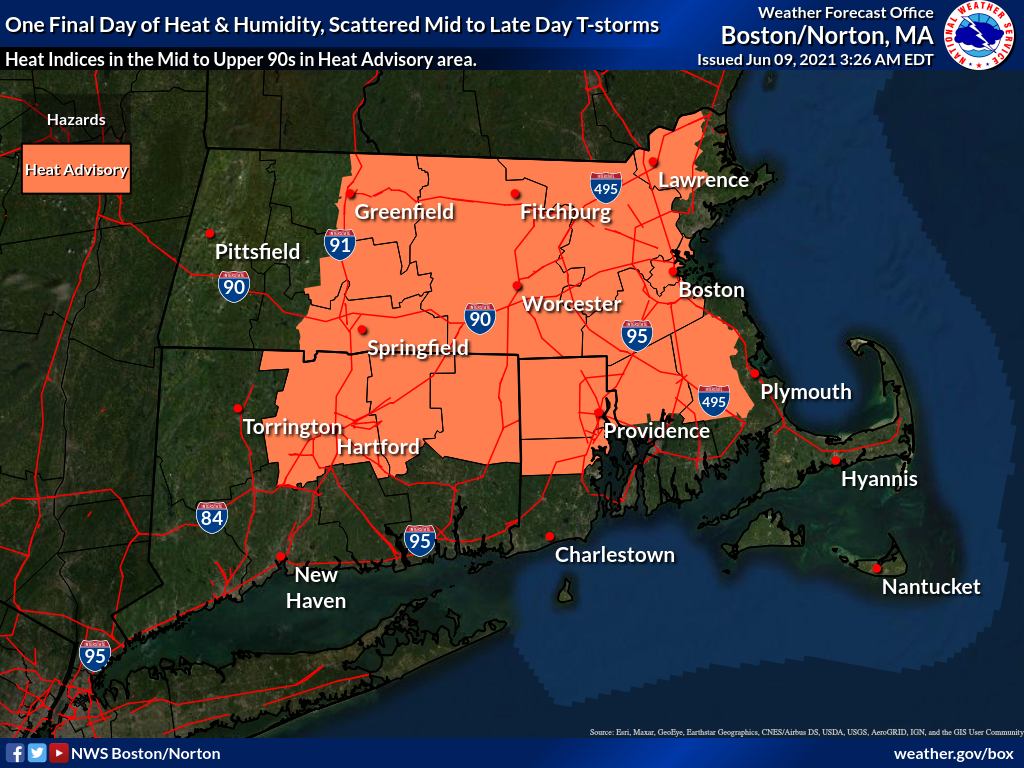
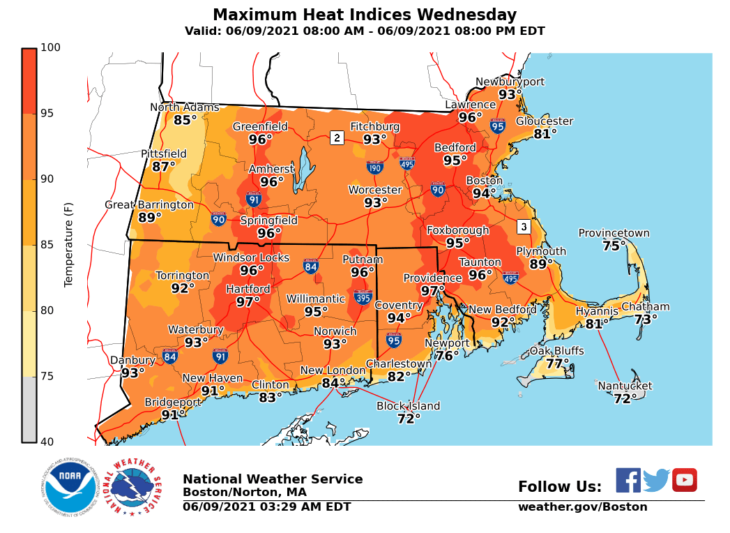
Good morning, Please find attached our latest briefing for the ongoing oppressive heat and the risk for scattered afternoon thunderstorms for today. *What has changed:* Heat Advisories for most (excluding the Berkshires, western and southern Connecticut and coastal sections of Massachusetts and Rhode Island). In effect from noon to 8 PM Wednesday. Heat indices are expected to rise into the mid to upper 90s in the Heat Advisory area. In addition, scattered thunderstorms will develop this afternoon and move from north to south. Heavy rain capable of localized street flooding is the main risk, but an isolated severe wind gust is possible. Cooler and much less humid weather will return on Thursday. Unless significant changes warrant otherwise, this will be the final briefing on the oppressive heat and humidity. Thank You! Meteorologists: Andrew Loconto and Matt Belk If you have any questions or would like more information, don't hesitate to contact us via this email address, on NWSChat <https://nwschat.weather.gov/>, or at the following: National Weather Service Boston/Norton, MA 46 Commerce Way Norton, MA 02766 508.622.3280 Website <http://www.weather.gov/boston> | Facebook <http://www.facebook.com/NWSBoston> | Twitter <http://www.twitter.com/NWSBoston>
participants (1)
-
 BOX Operations - NOAA Service Account