[2018.01.16 PM NWS Brief] 2 Systems To Monitor Through This Weekend

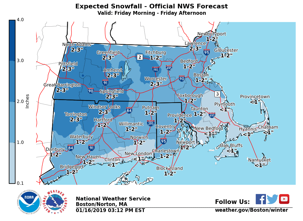
Good afternoon everyone, We continue to monitor two winter systems, one for early Friday, the other for the weekend. * Note that the single snowfall forecast attached to this email is for the Friday morning system only. The full set of briefing slides is for the weekend storm.* *Friday:* - Light snow begins between 1AM and 7AM Friday, impacting the commute for most of Southern New England. - Snowfall rates of less than 1 inch/hour are expected, with accumulations up to 3 inches across western MA, decreasing closer to the coastlines. (See attached snowfall map) - Snow changes to rain especially across the coastal plain of MA/RI during the afternoon. - Some untreated road surfaces may be covered. *Saturday night - Sunday night:* See the slides attached to this email. Heavy snow changing to an icy mix and then to rain, mainly across the southeast, is expected, along with a risk for strong winds, inland and coastal flooding. This storm is likely to be followed by a flash freeze beginning late day Sunday into Sunday night, with bitter cold air into Monday. Overall confidence is high for a moderate to high impact storm, but confidence in exact details and timing remains low at this time. We will continue to update into the weekend. If you have any questions or concerns please don't hesitate to contact us via this email address, on NWSChat <https://nwschat.weather.gov/>, or at the following: National Weather Service Boston/Norton, MA 46 Commerce Way Norton, MA 02766 508.622.3280 Website <http://www.weather.gov/boston> | Facebook <http://www.facebook.com/NWSBoston> | Twitter <http://www.twitter.com/NWSBoston>
participants (1)
-
 BOX Operations - NOAA Service Account