NWS Boston Emergency Management Briefing [9/19 PM] - Significant Marine Event Mon & Tue

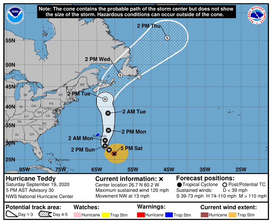
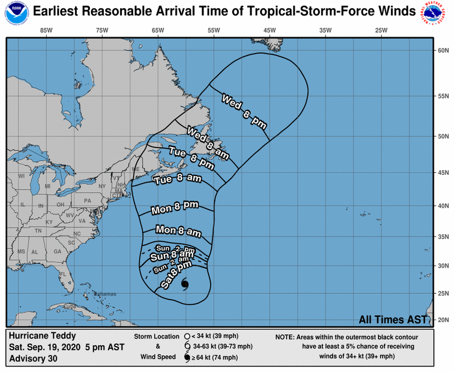
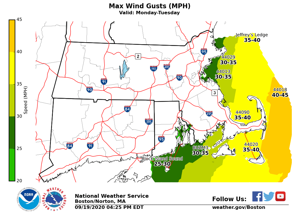
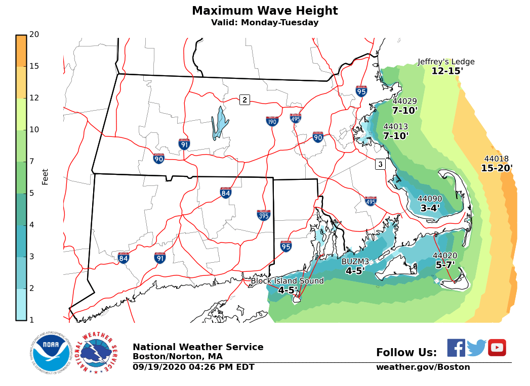
Good afternoon! There continues to be high confidence that Hurricane Teddy will pass well east of our region Monday and Tuesday. The main impact will be dangerously high seas for mariners across our eastern Massachusetts coastal waters, especially along Outer Cape Cod and Nantucket. Seas will build to between 12 and 17 feet with a period of North-northeast wind gusts of 30 to 40 knots. We have attached the expected track of Hurricane Teddy (issued at 5 PM), the earliest arrival time for tropical storm force winds, and our current wave height/wind gust forecasts. The only other impacts across our region will be persistent high surf/dangerous rip currents through Tuesday. There also will likely be pockets of minor coastal flooding/beach erosion along the eastern MA coastline during the afternoon high tide cycles through Tuesday. However, any coastal flooding should be minor and significant impacts are not expected. Please let us know if you have any questions. Thank you! If you have any questions or would like more information, don't hesitate to contact us via this email address, on NWSChat <https://nwschat.weather.gov/>, or at the following: National Weather Service Boston/Norton, MA 46 Commerce Way Norton, MA 02766 508.622.3280 Website <http://www.weather.gov/boston> | Facebook <http://www.facebook.com/NWSBoston> | Twitter <http://www.twitter.com/NWSBoston>
participants (1)
-
 BOX Operations - NOAA Service Account