[12.15.2022 AM] NWS Boston EM Briefing - High Terrain Heavy Wet Snow

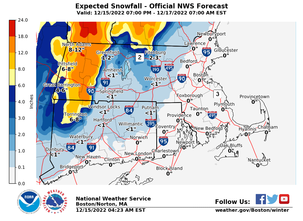
Good morning everyone, A potential high impact winter storm for elevations at and above 1000 ft in Massachusetts and Connecticut, beginning late Thursday night, and continuing Friday/Friday night, before tapering off early Saturday morning. A one pager with additional details is attached, along with an expected snowfall graphic. Forecast confidence has increased regarding snow totals and impacts, therefore Winter Storm Warnings and Winter Weather Advisories have been posted. Still some uncertainty on what exact elevation snowfall becomes significant, along with snow load issues (possible power outages). Frank Nocera & Bill Leatham If you have any questions or would like more information, don't hesitate to contact us via this email address, on NWSChat <https://nwschat.weather.gov/>, or at the following: National Weather Service Boston/Norton, MA 46 Commerce Way Norton, MA 02766 508.622.3280 Website <http://www.weather.gov/boston> | Facebook <http://www.facebook.com/NWSBoston> | Twitter <http://www.twitter.com/NWSBoston>
participants (1)
-
 BOX Operations - NOAA Service Account