[2025.08.22 PM] NWS Boston EM Briefing for Impacts of Erin

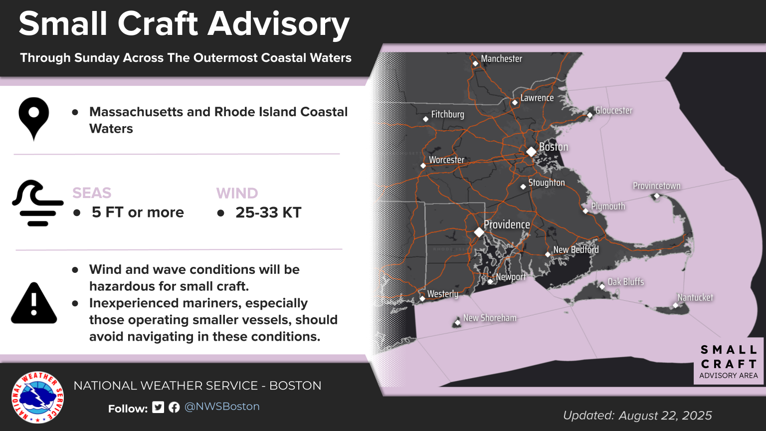
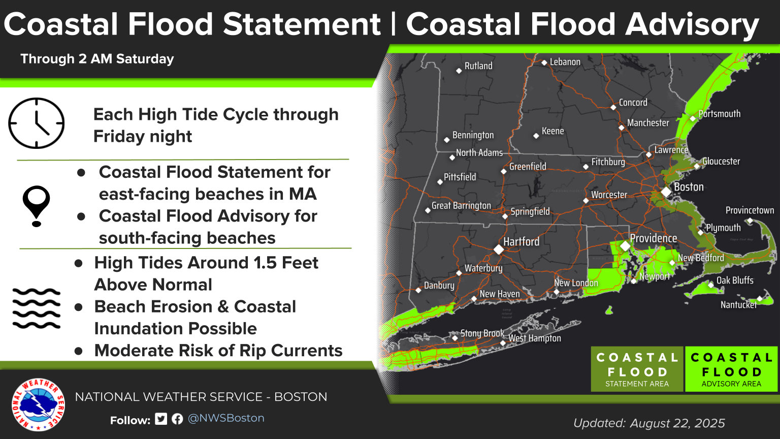
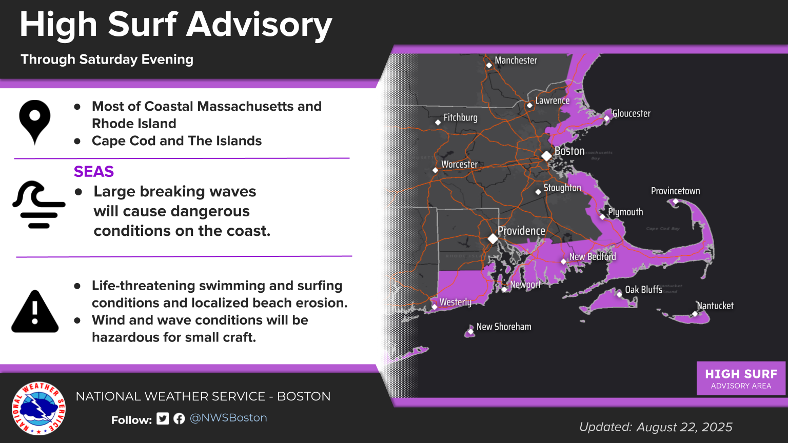
Good afternoon, all: Here is our latest briefing regarding the impacts of Hurricane Erin: Hurricane Erin has passed by our region earlier today but some fringe effects will still be felt across coastal areas of southern New England: High Surf and Rip Currents - High Surf Advisories are in effect into Saturday for most of the MA and RI coastline. - Focus is shifting from the beaches with south-facing exposures to those with an east-facing exposure tonight into Saturday. - Waves continue to diminish Sunday, but still expect at least a moderate risk for rip currents. - Water temperatures remain warm and some beachgoers may flock to the waters, which could put more people at risk. - Keep in mind that many beaches no longer have lifeguards for this season - Anyone going to view the surf should stay at a safe distance and off jetties or piers. - The risk for rip currents is expected to finally end for Monday. Significant Beach Erosion - Swell from Erin should result in dune and beach erosion on east-facing shores this weekend. - Again the focus is shifting away from south-facing beaches. Hazardous Marine Conditions on the Coastal Waters - Small Craft Advisories in effect for RI and MA coastal waters, except for Boston Harbor, Buzzards Bay and Narragansett Bay. - Winds are not much of a concern, it will take some time for rough seas to subside. Minor Coastal Flooding - Coastal Flood Advisories are in effect for Martha’s Vineyard and Nantucket for the high tides late tonight, and for Narragansett Bay and south coastal MA/RI for the high tides this evening. - Minor coastal flooding is expected in vulnerable sections of Nantucket Harbor, Edgartown Harbor, Vineyard Haven, and Oak Bluffs this evening with a storm surge of 1 to 2 feet and waves up to 8 feet on Nantucket Sound. Low-end Moderate flooding is possible near Nantucket Harbor if we see a storm surge closer to 2 feet. - Minor coastal flooding is expected in low lying areas around Narragansett Bay and the South Coast around high tide this evening with a storm surge of 1 to 2 feet. - No significant coastal flooding is expected along the E MA coast, but water levels could reach Action stage during high tides tonight. This is expected to be our final briefing, unless there is a significant change to the forecast. Meteorologists Matthew Belk, Francis Tarasiewicz and Caity Mensch If you have any questions or would like more information, please don't hesitate to contact us. You can reach us via: email: box.operations@noaa.gov phone: 508.622.3280 Slack/NWSChat 2.0 <https://nwschatws.slack.com/> (for approved partners) social media: Website <http://www.weather.gov/boston> | Facebook <http://www.facebook.com/NWSBoston> | Twitter <http://www.twitter.com/NWSBoston>
participants (1)
-
 BOX Operations - NOAA Service Account