[2025.01.17 PM] NWS Boston EM Briefing - Snow Potential Sunday Night & Bitter Cold early next week

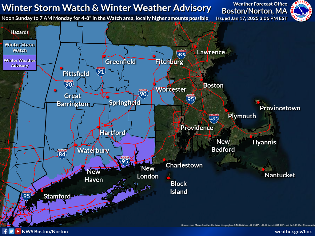
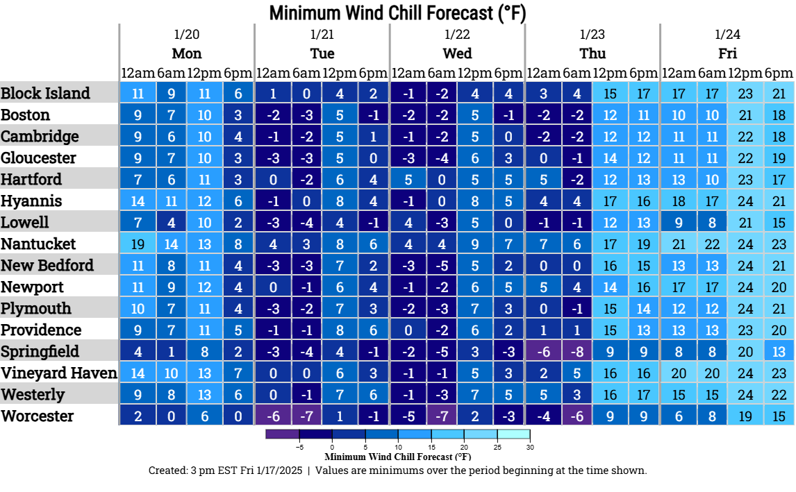
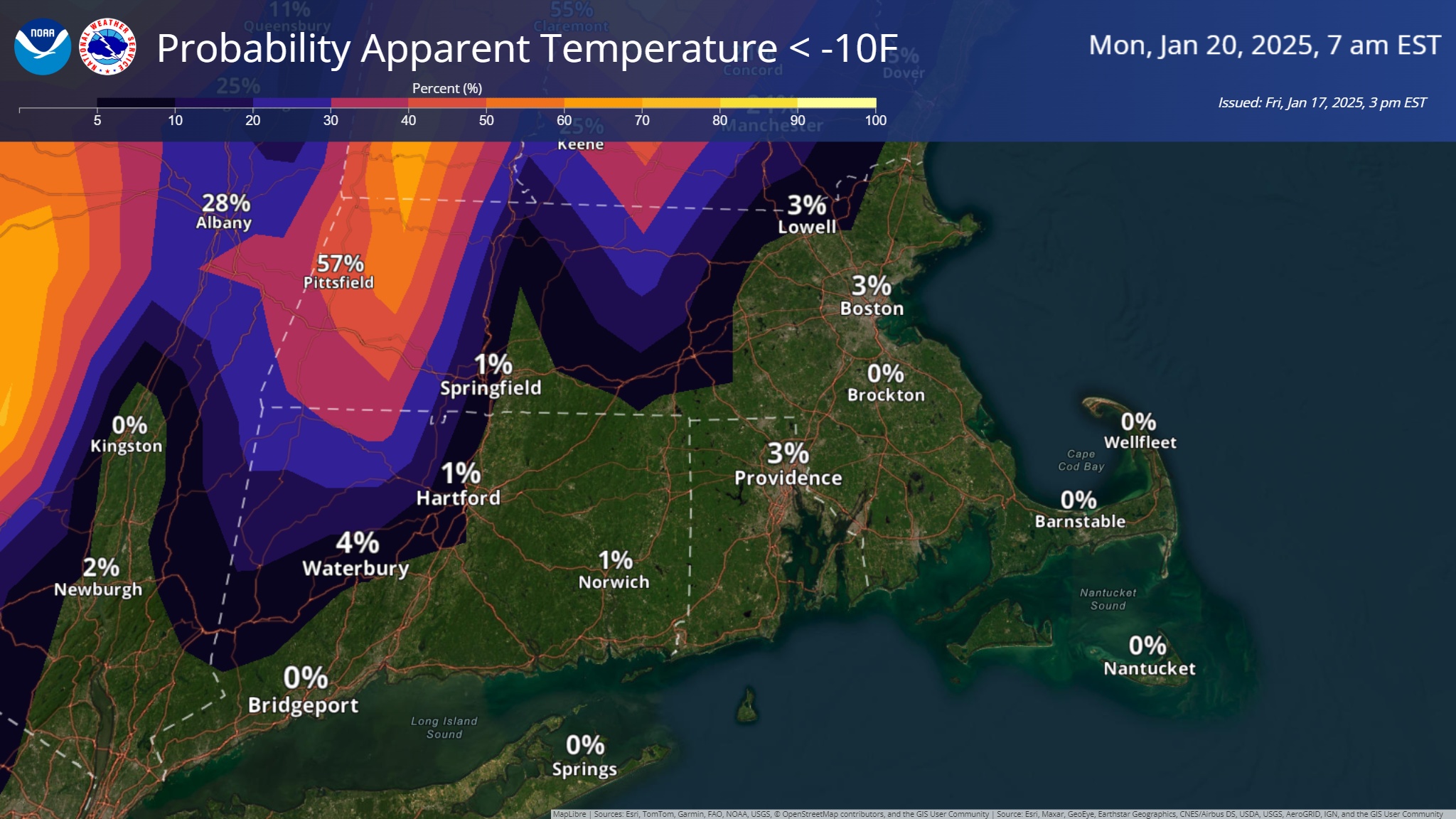
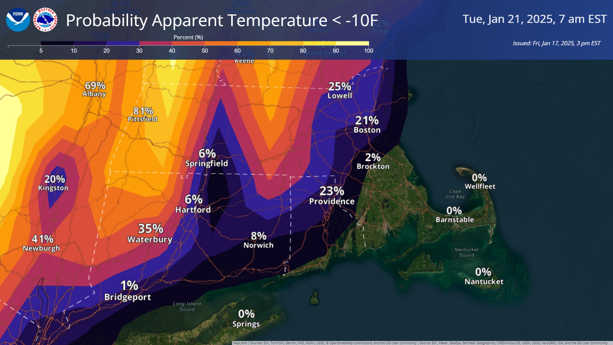
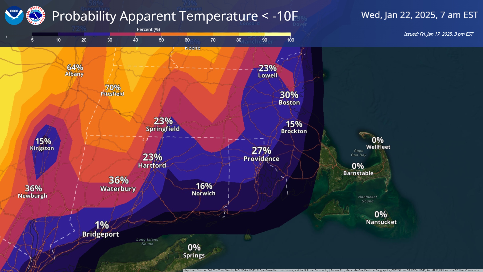
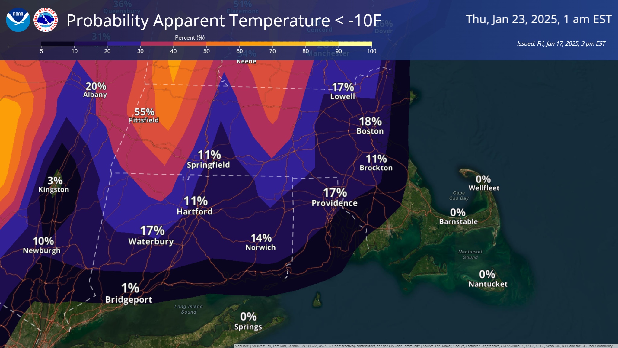
Good afternoon everyone, Here is the latest update regarding the potential snowfall late Sunday, Sunday night into early Monday morning and the bitterly cold weather to follow early next week. *Snow Potential...* - Snow arrives Sunday afternoon, with the steadiest and heaviest snow Sunday evening and overnight, then tapering off early Monday morning. - Still 2 days away, so uncertainty on exact location of the rain/snow line, areas of heaviest snow bands and exact snow amounts. - The potential exists for 4-8" of snow in the watch area, with locally higher amounts possible, depending on the location and duration of heavier snow bands. Less snow is expected along and south of the rain/snow line, location to be determined. - Attached is a graphic with the winter storm/winter weather advisory configuration. *Bitter Cold...* - Core of the coldest air is from Monday night into Wednesday night. - Daytime highs only 15-20F and nighttime lows -5F to +5F - Wind chills as cold as zero to -10F, possibly as cold as -20F in the Berkshires - Wind chill graphics attached Meteorologists Andrew Loconto, Matt Belk and Frank Nocera If you have any questions or would like more information, please don't hesitate to contact us. You can reach us via: email: box.operations@noaa.gov phone: 508.622.3280 Slack/NWSChat 2.0 <https://nwschatws.slack.com/> (for approved partners) social media: Website <http://www.weather.gov/boston> | Facebook <http://www.facebook.com/NWSBoston> | Twitter <http://www.twitter.com/NWSBoston>
participants (1)
-
 BOX Operations - NOAA Service Account