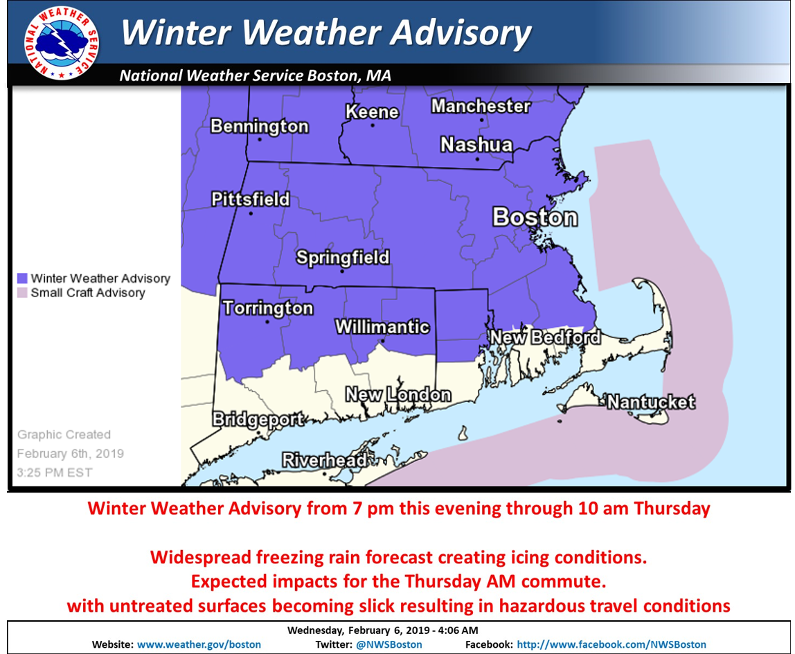
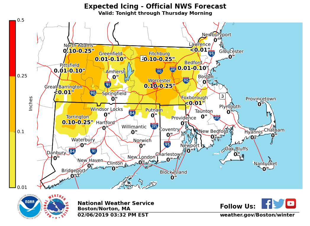
[2019.02.06 PM NWS Briefing] Icing This Evening Through the Thursday AM Commute

Good afternoon, A wintry mix of freezing rain with isolated sleet mixed in will develop this evening between 5 and 9 pm, advancing from west to east. It will continue through Thursday morning before transitioning to drizzle by midday. *WINTER WEATHER ADVISORIES* continue. Forecast ice amounts are attached. *Greatest concern * - Icing during the Thursday AM commute, especially across interior areas of Southern New England away from the immediate coast. - Untreated roads will become slick resulting in hazardous travel conditions. - Low risk of downed limbs due to the weight of ice with the potential for isolated power outages; best chance in the East Slopes of the Berkshires and the Worcester Hills. *Uncertainty * - Highest confidence is in western and central Massachusetts and icing potential is low for southern Rhode Island and southeast coastal Massachusetts. Please let us know if you have any questions or concerns. Thank You Bryce Williams National Weather Service Boston/Norton, MA 46 Commerce Way Norton, MA 02766 508.622.3280 Website <http://www.weather.gov/boston> | Facebook <http://www.facebook.com/NWSBoston> | Twitter <http://www.twitter.com/NWSBoston>
participants (1)
-
 BOX Operations - NOAA Service Account