
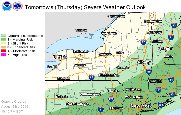
**** The information in this email pertains to the following areas only:**** *- In Connecticut: Litchfield County* *- In Massachusetts: Berkshire County* *- In Vermont: Bennington & Windham Counties* *- In New York: Columbia, Dutchess, Greene, Rensselaer, and Ulster Counties* Dear Emergency Managers and other partners, The severe threat has ended tonight, but another round is possible tomorrow afternoon. There is a Marginal risk for severe thunderstorms on Thursday for the eastern Catskills, mid Hudson Valley, and the Taconics and most of adjacent western New England. The best chance for severe thunderstorms will be Thursday afternoon. The greatest threat from these thunderstorms will be damaging wind gusts. However, large hail will also be possible. Locally heavy rain may also produce ponding of water in poor drainage, urban and low lying areas. Isolated flash flooding is possible, especially in areas where multiple thunderstorms occur. Please see the attached image for more details. If you have any questions, please feel free to contact us via: 1. Email: alb.stormreport@noaa.gov 2. NWSChat at https://nwschat.weather.gov/live/ 3. Social Media: Facebook <https://www.facebook.com/NWSAlbany> and Twitter <https://twitter.com/NWSAlbany> 4. Telephone: (518) 435-9575 <518-435-9575> Sincerely, NWS Albany www.weather.gov/albany