
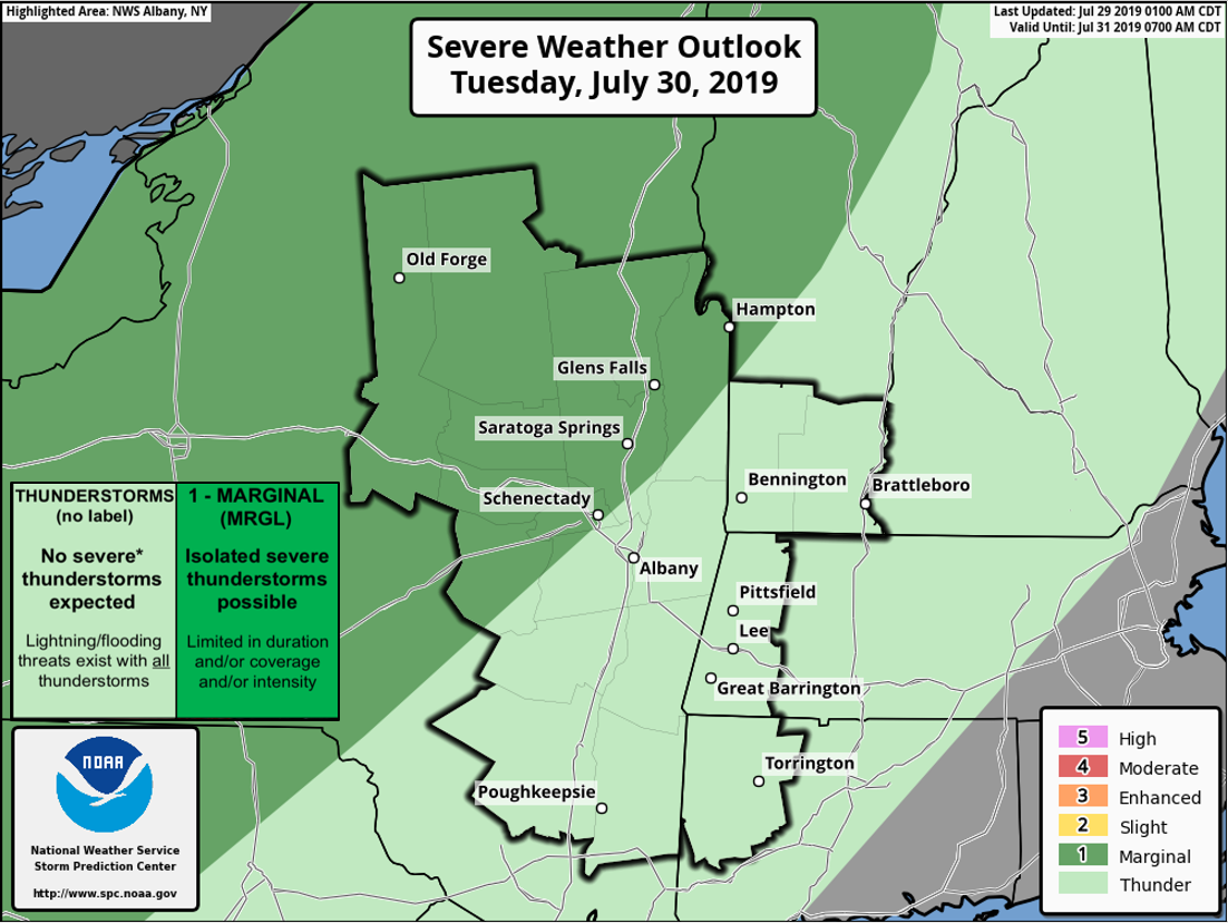
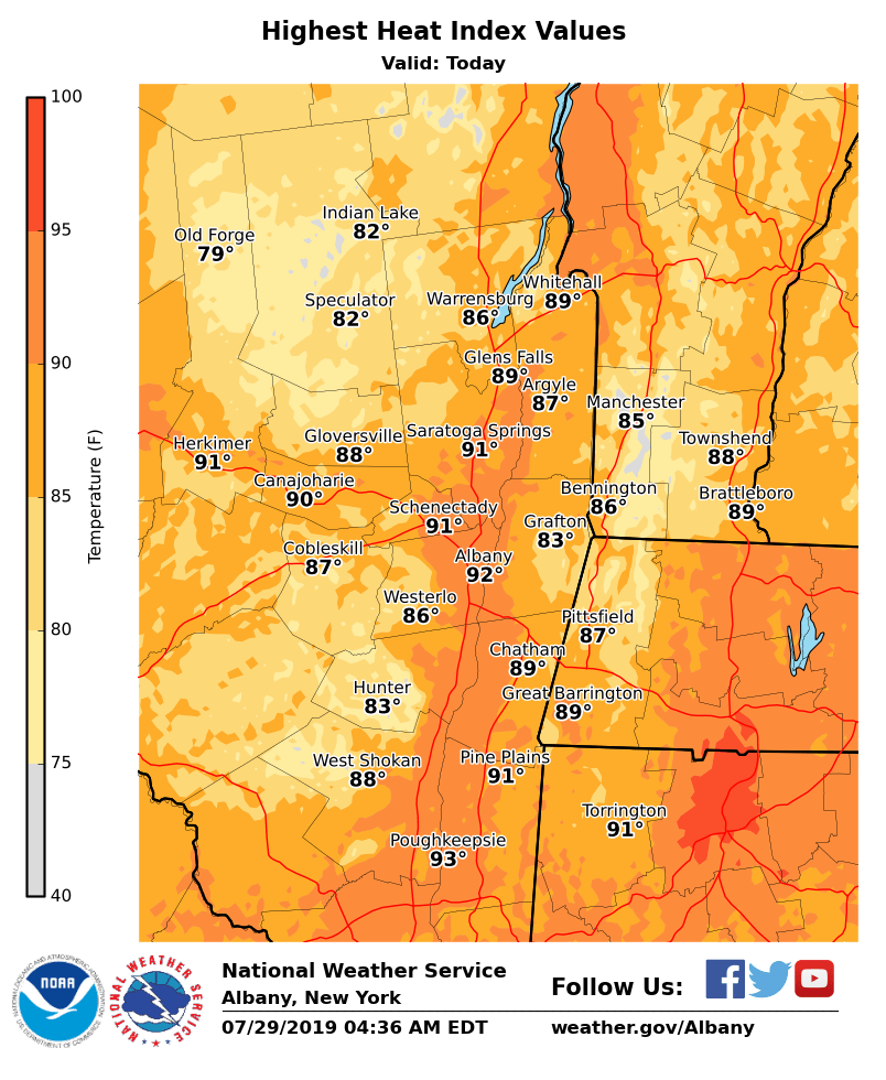
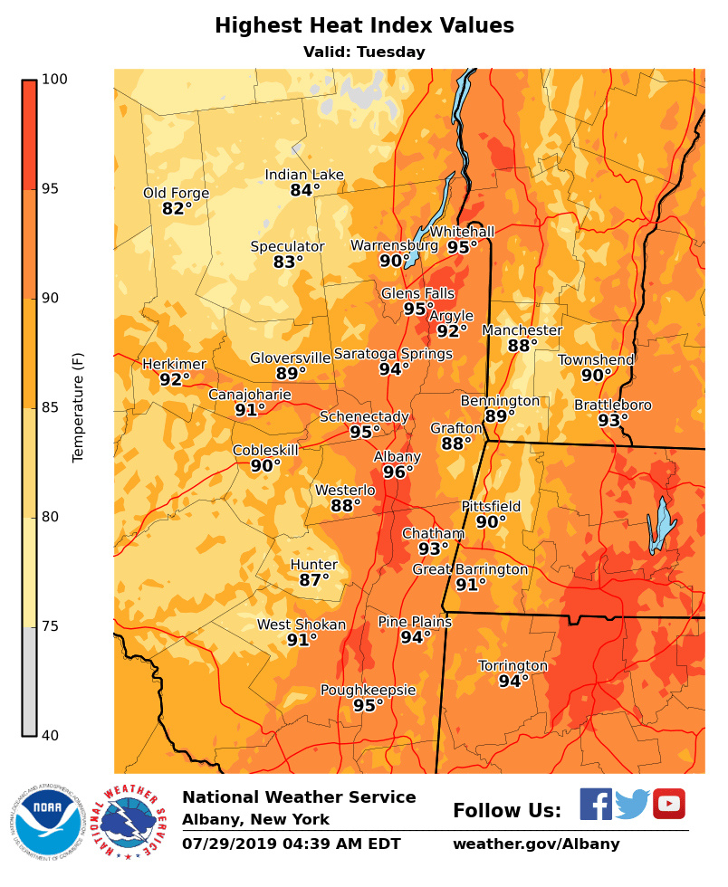
**** The information in this email pertains to the following areas only:**** *- In Connecticut: Litchfield County* *- In Massachusetts: Berkshire County* *- In Vermont: Bennington & Windham Counties* *- In New York: Albany, Columbia, Dutchess, Fulton, Hamilton, Herkimer, Montgomery, Greene, Rensselaer, Saratoga, Schenectady, Schoharie, Ulster, Warren and Washington Counties* Dear Emergency Managers and other partners, *Heat and Humidity* Heat indices today and Tuesday afternoon may reach the mid-90s over the Hudson Valley. A Heat Advisory may be needed for some areas on Tuesday. The combination of hot temperatures and high humidity may result in an increased risk for heat-related illnesses. *Thunderstorms* Isolated thunderstorms are expected across the region today. Scattered thunderstorms will overspread much of the region Tuesday afternoon into the evening. Some thunderstorms will be capable of becoming strong-to-severe. Locations north and west of the Capital Region have been outlined with a Marginal Risk for Severe Thunderstorms from the Storm Prediction Center. Please refer to the attached images for additional information. If you have any questions, please feel free to contact us via: 1. Email: alb.stormreport@noaa.gov 2. NWSChat at https://nwschat.weather.gov/live/ 3. Social Media: Facebook <https://www.facebook.com/NWSAlbany> and Twitter <https://twitter.com/NWSAlbany> 4. Telephone: (518) 435-9575 <518-435-9575> Sincerely, NWS Albany www.weather.gov/albany