
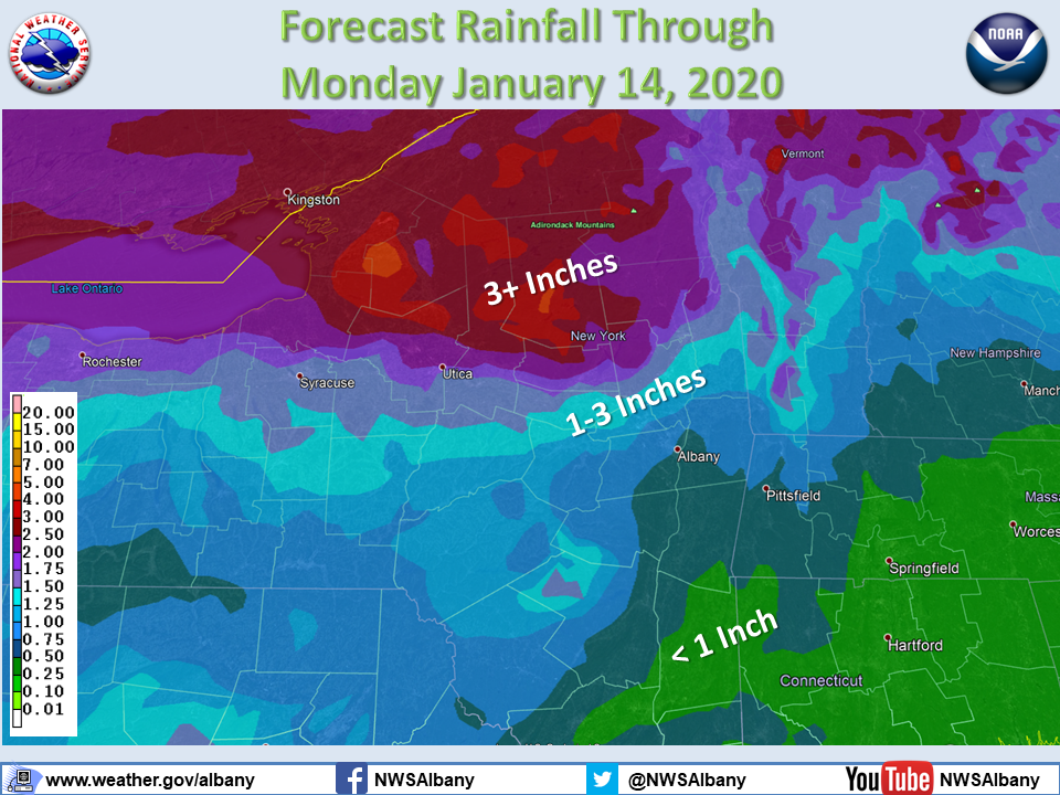
**** The information in this email pertains to the following areas only:**** *- In Connecticut: Litchfield County* *- In Massachusetts: Berkshire County* *- In Vermont: Bennington & Windham Counties* *- In New York: Albany, Columbia, Dutchess, Fulton, Hamilton, Herkimer, Montgomery, * * Greene, Rensselaer, Saratoga, Schenectady, Schoharie, Ulster, Warren and Washington * * Counties* Dear Emergency Managers and other partners, A strong storm system is expected to produce a widespread moderate to locally heavy rainfall event across the region Friday into Sunday. Anomalously high moisture content and periods of heavy rain may lead to flooding including those within urban and poor drainage areas. Additionally, there is potential for river flooding due to the combination of snowmelt and heavy rainfall. The heaviest rainfall is expected across the southern Adirondacks, Mohawk Valley and Lake George Saratoga regions. Stay tuned for further updates from your National Weather Service. In addition, a brief period of a wintry mix, including freezing rain, sleet and snow is possible early Sunday morning, mainly north of I-90. See attached forecast rainfall amounts graphic. If you have any questions, please feel free to contact us via: 1. Email: alb.stormreport@noaa.gov 2. NWSChat at https://nwschat.weather.gov/live/ 3. Social Media: Facebook <https://www.facebook.com/NWSAlbany> and Twitter <https://twitter.com/NWSAlbany> 4. Telephone: (518) 435-9575 <518-435-9575> Sincerely, NWS Albany www.weather.gov/albany