
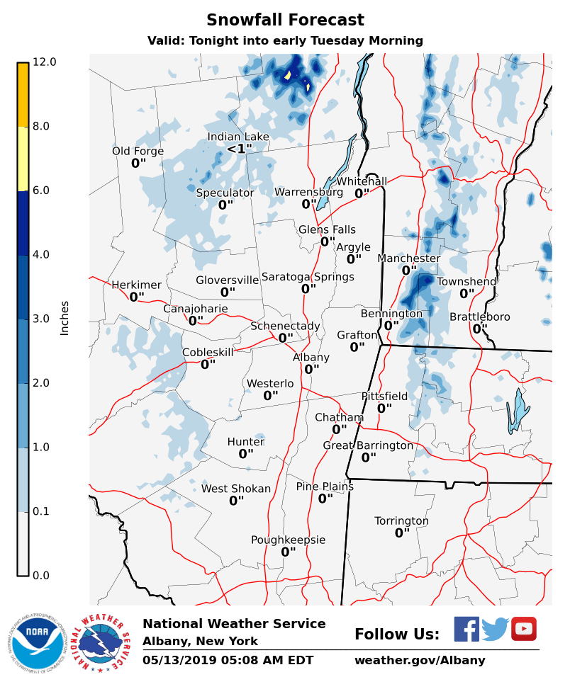
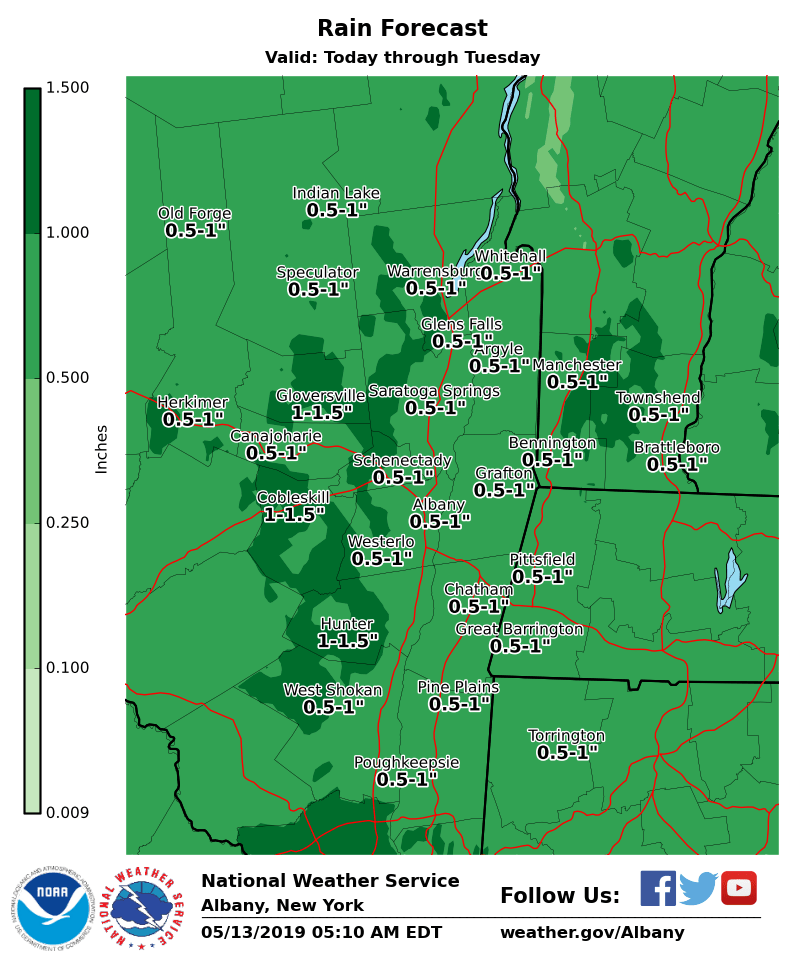
**** The information in this email pertains to the following areas only:**** *- In Connecticut: Litchfield County* *- In Massachusetts: Berkshire County* *- In Vermont: Bennington & Windham Counties* *- In New York: Albany, Columbia, Dutchess, Fulton, Hamilton, Herkimer, Montgomery, Greene, Rensselaer, Saratoga, Schenectady, Schoharie, Ulster, Warren and Washington Counties* Dear Emergency Managers and other partners, Although today will start out dry, it will be another cloudy and chilly day, with more rain arriving for this afternoon into tonight. Rain will mix with or changeover to snow across the higher elevations tonight across the southern Adirondacks, eastern Catskills, northern Berkshires and the southern Green Mountains of Vermont. Wet snow will be seen at elevations above 1500 feet, although accumulations of 1 to 4 inches will generally occur for areas above 2500 feet. Cloudy and chilly weather with additional rain will linger into Tuesday before some improvement in the weather occurs for Wednesday. Attached is our rainfall and snowfall forecasts. If you have any questions, please feel free to contact us via: 1. Email: alb.stormreport@noaa.gov 2. NWSChat at https://nwschat.weather.gov/live/ 3. Social Media: Facebook <https://www.facebook.com/NWSAlbany> and Twitter <https://twitter.com/NWSAlbany> 4. Telephone: (518) 435-9575 <518-435-9575> Sincerely, NWS Albany www.weather.gov/albany