
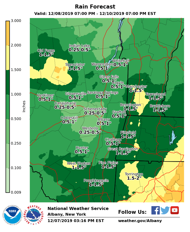
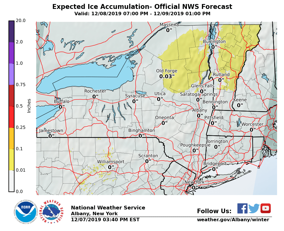
**** The information in this email pertains to the following areas only:**** *- In Connecticut: Litchfield County* *- In Massachusetts: Berkshire County* *- In Vermont: Bennington & Windham Counties* *- In New York: Albany, Columbia, Dutchess, Fulton, Hamilton, Herkimer, Montgomery, Greene, Rensselaer, Saratoga, Schenectady, Schoharie, Ulster, Warren and Washington Counties* Dear Emergency Managers and other partners, Mild temperatures and periods of rain are expected late Sunday night into Tuesday. The rain may begin as a wintry mix of sleet and freezing rain for the southern Adirondacks Sunday night, with ice accretion less than a tenth of an inch expected (see graphic below). Roads may briefly become slippery. Temperatures are expected to rise above freezing by Monday morning. Around 0.50 to 1.50" rain is expected across eastern New York and western New England Sunday night into Tuesday (see expected rainfall graphic below). The rain and mild temperatures will likely result in some melting of the snowpack and runoff, which will result in river rises. Widespread flooding is not expected at this time, but some rivers may reach action stage and approach minor flood stage. Some nuisance flooding is possible in urban and flood prone areas, especially where snow banks block storm drains. If you have any questions, please feel free to contact us via: 1. Email: alb.stormreport@noaa.gov 2. NWSChat at https://nwschat.weather.gov/live/ 3. Social Media: Facebook <https://www.facebook.com/NWSAlbany> and Twitter <https://twitter.com/NWSAlbany> 4. Telephone: (518) 435-9575 <518-435-9575> Sincerely, NWS Albany www.weather.gov/albany