
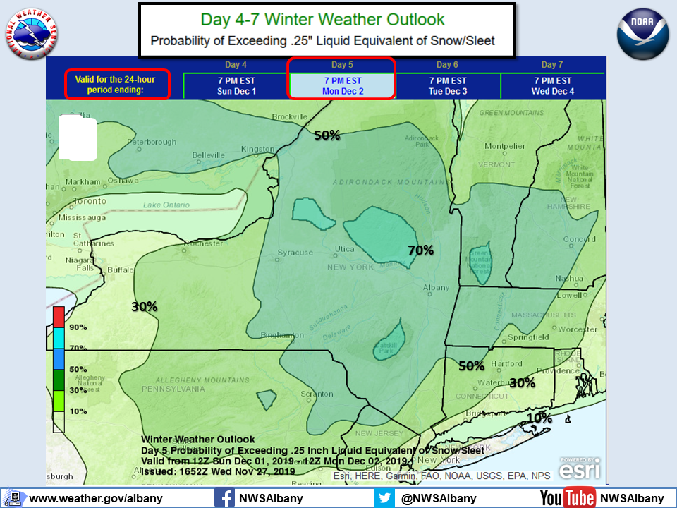
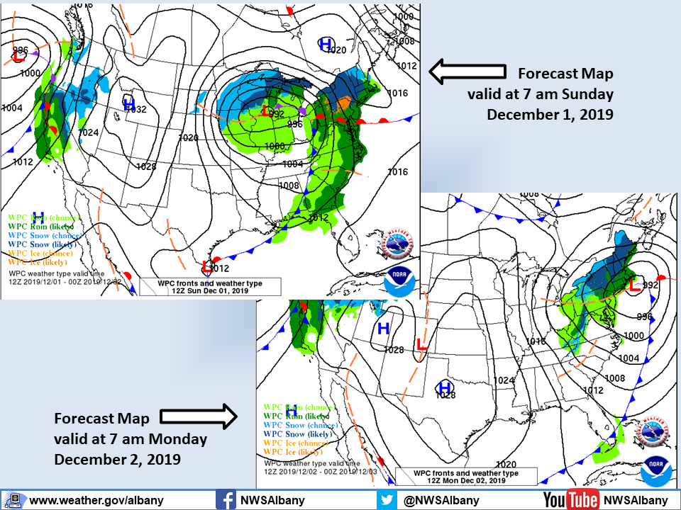
**** The information in this email pertains to the following areas only:**** *- In Connecticut: Litchfield County* *- In Massachusetts: Berkshire County* *- In Vermont: Bennington & Windham Counties* *- In New York: Albany, Columbia, Dutchess, Fulton, Hamilton, Herkimer, Montgomery, Greene, Rensselaer, Saratoga, Schenectady, Schoharie, Ulster, Warren and Washington Counties* Dear Emergency Managers and other partners, Strong northwesterly winds gusting up to 30-45 mph are expected after midnight tonight and Thanksgiving Day. The strongest winds are expected to occur across the eastern Catskills, down the Mohawk Valley across the Capital District into the Taconics and Berkshires as well as across the southern Green Mountains. If wind gusts in excess of 45 mph are expected then a wind advisory <https://www.weather.gov/media/aly/FactSheets/NYSWind.pdf> will be issued. Please refer to the attached slide "windGUSTS" for details. A storm is expected to impact region with snow likely Sunday into Monday. However, there remains uncertainty regarding how close the storm will track to the coast and its exact timing and speed. All these will impact precipitation type, intensity and amounts. What has become more certain is travel plans will be impacted. Please refer to the attached slide "Outlook_Snow_Sleet_SundayNight-Monday" for the possibility for a plowable snowfall which has increased across the region. If you have any questions, please feel free to contact us via: 1. Email: alb.stormreport@noaa.gov 2. NWSChat at https://nwschat.weather.gov/live/ 3. Social Media: Facebook <https://www.facebook.com/NWSAlbany> and Twitter <https://twitter.com/NWSAlbany> 4. Telephone: (518) 435-9575 <518-435-9575> Sincerely, NWS Albany www.weather.gov/albany