
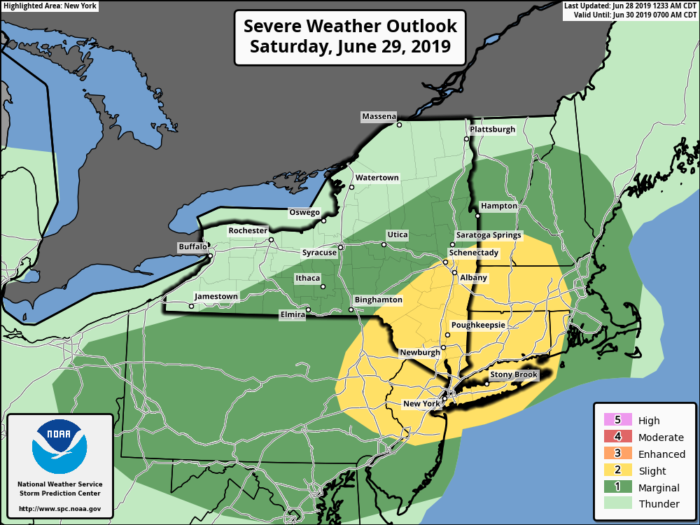
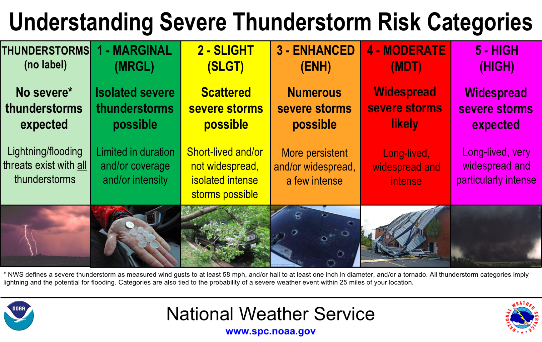
**** The information in this email pertains to the following areas only:**** *- In Connecticut: Litchfield County* *- In Massachusetts: Berkshire County* *- In Vermont: Bennington & Windham Counties* *- In New York: Albany, Columbia, Dutchess, Fulton, Hamilton, Herkimer, Montgomery, Greene, Rensselaer, Saratoga, Schenectady, Schoharie, Ulster, Warren and Washington Counties* Dear Emergency Managers and other partners, The National Weather Service Storm Prediction Center (SPC) has outlined a 'Slight Risk' for severe thunderstorms on Saturday (see attached graphics). This potential for severe weather will occur along and ahead of a strong cold front. The window of opportunity would be along and south of a line from Interstate 90 in New York and Route 7 through southern Vermont through the afternoon hours. Main threat will be from damaging wind gusts, along with dangerous cloud to ground lightning strikes. If you have any questions, please feel free to contact us via: 1. Email: alb.stormreport@noaa.gov 2. NWSChat at https://nwschat.weather.gov/live/ 3. Social Media: Facebook <https://www.facebook.com/NWSAlbany> and Twitter <https://twitter.com/NWSAlbany> 4. Telephone: (518) 435-9575 <518-435-9575> Sincerely, NWS Albany www.weather.gov/albany