
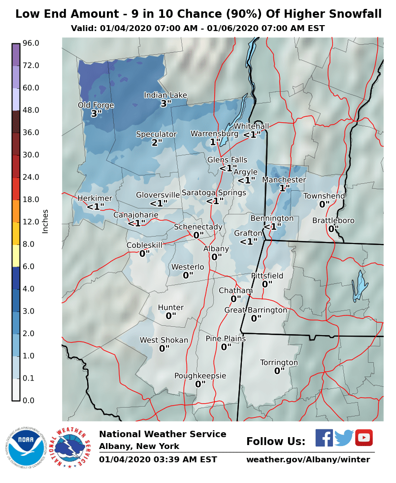
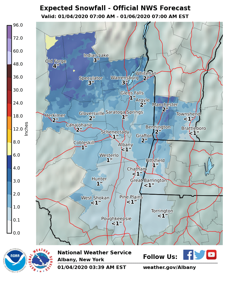
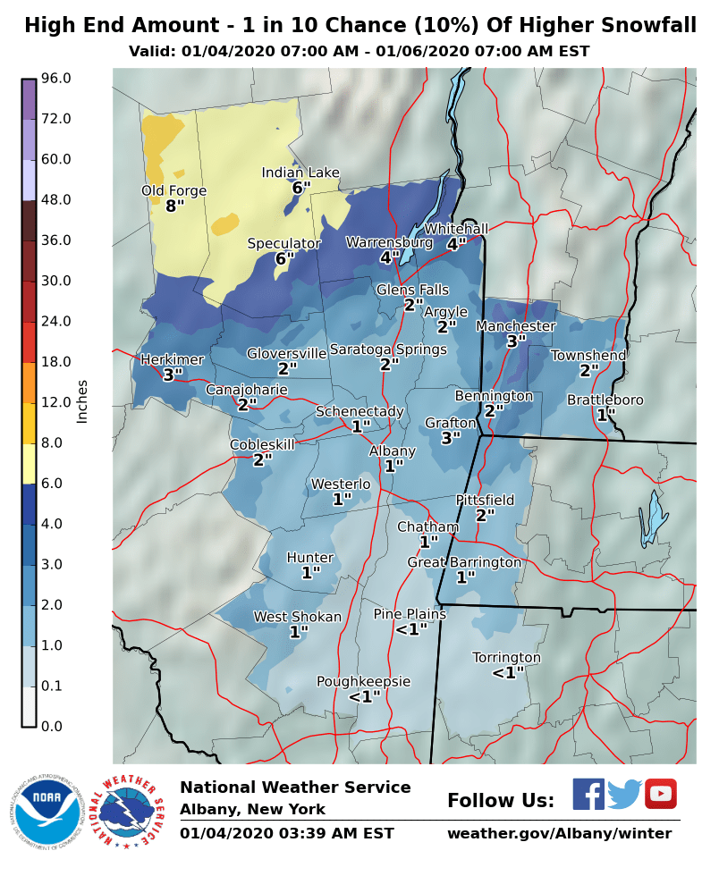
**** The information in this email pertains to the following areas only:**** *- In Connecticut: Litchfield County* *- In Massachusetts: Berkshire County* *- In Vermont: Bennington & Windham Counties* *- In New York: Albany, Columbia, Dutchess, Fulton, Hamilton, Herkimer, Montgomery, Greene, Rensselaer, Saratoga, Schenectady, Schoharie, Ulster, Warren and Washington Counties* Dear Emergency Managers and other partners, A storm system bringing rain to the region today could transition to a period of wet snow in the higher terrain areas of the Adirondacks, Lake George/northern Saratoga region, and southern Greens this morning into early afternoon. Wet snow could mix back with rain as it becomes lighter this afternoon before ending this evening. Total wet snow amounts should range between 2 and 4 inches across these higher terrain areas with amounts up to 4 to 6 inches in the highest peaks. Should we expect more widespread snow amounts exceeding 4 inches, we may need to issue a Winter Weather Advisory. Please consult attached maps for more specific information. A second event arrives Sunday night into early Monday bringing a widespread light snow event with amounts ranging between a coating up to 1 inch. Given the timing of the event and colder temperatures, slippery travel conditions may occur for the Monday morning commute. Then, confidence is increasing that another snow event will occur Tuesday night into Wednesday bringing light to moderate snowfall amounts to the region. If you have any questions, please feel free to contact us via: 1. Email: alb.stormreport@noaa.gov 2. NWSChat at https://nwschat.weather.gov/live/ 3. Social Media: Facebook <https://www.facebook.com/NWSAlbany> and Twitter <https://twitter.com/NWSAlbany> 4. Telephone: (518) 435-9575 <518-435-9575> Sincerely, NWS Albany www.weather.gov/albany