
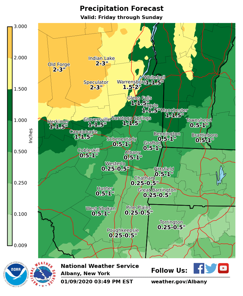
**** The information in this email pertains to the following areas only:**** *- In Connecticut: Litchfield County* *- In Massachusetts: Berkshire County* *- In Vermont: Bennington & Windham Counties* *- In New York: Albany, Columbia, Dutchess, Fulton, Hamilton, Herkimer, Montgomery, * * Greene, Rensselaer, Saratoga, Schenectady, Schoharie, Ulster, Warren and Washington * * Counties* Dear Emergency Managers and other partners, A variety of weather hazards are possible this weekend. A brief period of sleet and or freezing rain will be possible for areas north and west of the Capital District Friday morning, with a light glaze of ice possible. If the confidence in freezing rain increases, then A Winter Weather Advisory will be issued. In addition, a period of freezing rain is possible early Sunday morning between midnight and 7AM over portions of the southern Adirondacks. A strong storm system is expected to produce a widespread moderate to locally heavy rainfall event across the region Saturday into Sunday. The heaviest rainfall is expected across the southern Adirondacks, Mohawk Valley and Lake George Saratoga regions. There is potential for river flooding in these areas due to the combination of snowmelt and heavy rainfall. Also, a line of showers, with some thunderstorms possible, will cross eastern New York and western New England Sunday morning. These showers may bring a brief period of heavy rainfall and strong wind gusts. These heavier showers may cause some localized urban and poor drainage flooding on Sunday morning. Please see attached forecast rainfall amounts graphic. If you have any questions, please feel free to contact us via: 1. Email: alb.stormreport@noaa.gov 2. NWSChat at https://nwschat.weather.gov/live/ 3. Social Media: Facebook <https://www.facebook.com/NWSAlbany> and Twitter <https://twitter.com/NWSAlbany> 4. Telephone: (518) 435-9575 <518-435-9575> Sincerely, NWS Albany www.weather.gov/albany