
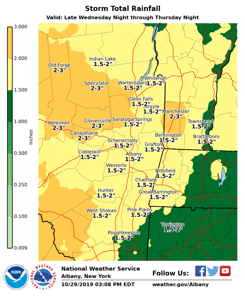
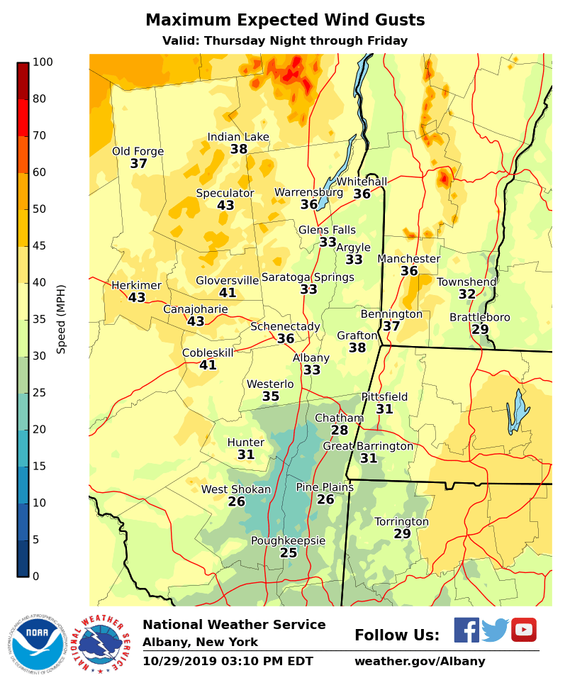
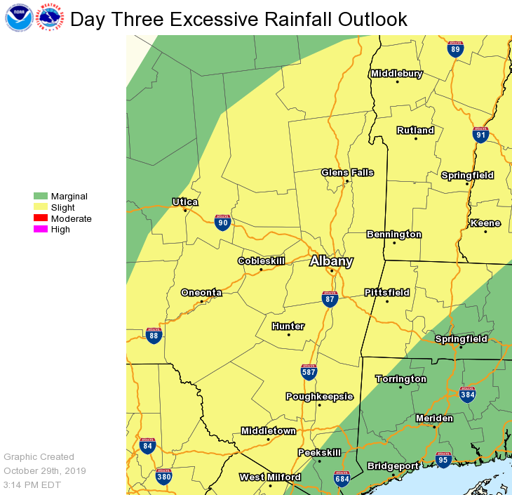
**** The information in this email pertains to the following areas only:**** *- In Connecticut: Litchfield County* *- In Massachusetts: Berkshire County* *- In Vermont: Bennington & Windham Counties* *- In New York: Albany, Columbia, Dutchess, Fulton, Hamilton, Herkimer, Montgomery, Greene, Rensselaer, Saratoga, Schenectady, Schoharie, Ulster, Warren and Washington Counties* Dear Emergency Managers and other partners, A storm system will bring rainfall to the region late Wednesday night through Thursday night. The heaviest rainfall will occur Thursday evening into Thursday night. Storm total rainfall amounts will be 1 to 3 inches, with the heaviest totals across the Adirondacks and in southern Vermont. The rainfall will result in rises on area waterways, with river flooding a possibility. The greatest threat for river flooding will be for areas north of Interstate 90. Some minor flooding of urban and poor drainage areas is also possible. Due to high rainfall rates, there is marginal to slight risk for flash flooding, especially within urban areas. A Flood Watch will likely be needed. In addition, winds will become gusty for late Thursday night and into the day on Friday behind the departing storm system. Winds may gusts over 35 mph, which may result in some downed tree limbs. If you have any questions, please feel free to contact us via: 1. Email: alb.stormreport@noaa.gov 2. NWSChat at https://nwschat.weather.gov/live/ 3. Social Media: Facebook <https://www.facebook.com/NWSAlbany> and Twitter <https://twitter.com/NWSAlbany> 4. Telephone: (518) 435-9575 <518-435-9575> Sincerely, NWS Albany www.weather.gov/albany