
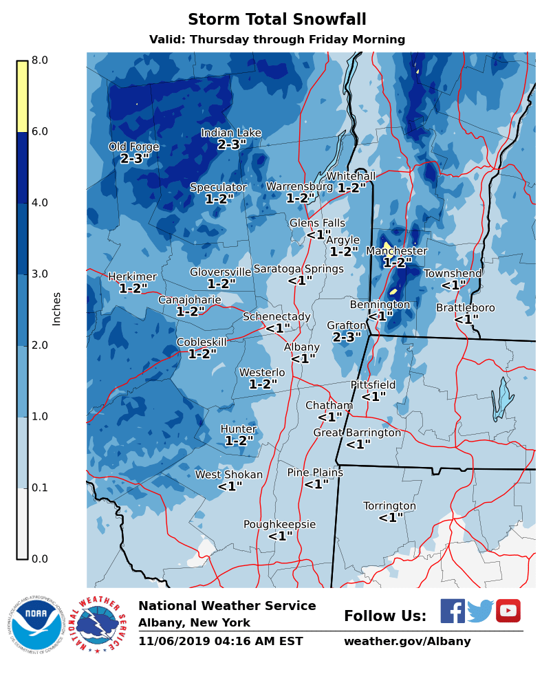
Dear Emergency Managers and other partners, A storm system is still expected to impact the region for Thursday into Thursday night. Initially, temperatures should be warm enough for the precipitation to fall as rain during the day on Thursday, although the Adirondacks may be cold enough for precipitation to begin as snow. Temperatures should cool quickly after sunset and allow rain to mix with and transition to wet snow for Thursday night throughout all of eastern New York and western New England. Temperatures overnight are expected to cool below freezing across the entire region and therefore some wet snow accumulations are possible. Precipitation will taper off after midnight and any precipitation will be done by daybreak on Friday, allowing for a cold and windy day for Friday. Storm total snow amounts are expected to be an inch or less for most valley areas, with a few inches across higher terrain areas. Locally 3 to 6 inches are expected across the highest peaks of the southern Adirondacks and southern Green Mountains of Vermont. See the attached map for our current snowfall forecast. If you have any questions, please feel free to contact us via: 1. Email: alb.stormreport@noaa.gov 2. NWSChat at https://nwschat.weather.gov/live/ 3. Social Media: Facebook <https://www.facebook.com/NWSAlbany> and Twitter <https://twitter.com/NWSAlbany> 4. Telephone: (518) 435-9575 <518-435-9575> Sincerely, NWS Albany www.weather.gov/albany