
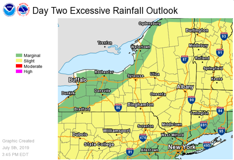
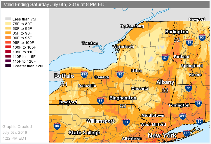
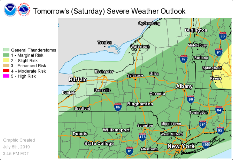
ALB Stormreport - NOAA Service Account <alb.stormreport@noaa.gov> [image: Attachments]4:33 AM (11 hours ago) to bcc: _NWS, bcc: _NWS, bcc: _NWS, bcc: _NWS **** The information in this email pertains to the following areas only:**** *- In Connecticut: Litchfield County* *- In Massachusetts: Berkshire County* *- In Vermont: Bennington & Windham Counties* *- In New York: Albany, Columbia, Dutchess, Fulton, Hamilton, Herkimer, Montgomery, Greene, Rensselaer, Saratoga, Schenectady, Schoharie, Ulster, Warren and Washington Counties* Dear Emergency Managers and other partners, The combination of hot temperatures and increasing humidity levels may produce dangerous heat conditions with heat indices into the lower to mid 90s in portions of the Capital District and mid Hudson Valley again on Saturday. If confidence increases in heat indices of 95 F or greater, then heat advisories will be issued. In addition, showers and thunderstorms are expected to become numerous to widespread area-wide on Saturday, especially in the afternoon and evening. Heavy downpours are likely in any thunderstorm, which could result in urban and poor drainage flooding. Isolated flash flooding is possible if multiple rounds of thunderstorms occur over a given area. There is also a marginal risk of severe weather with the main threat being isolated damaging wind gusts. If you have any questions, please feel free to contact us via: 1. Email: alb.stormreport@noaa.gov 2. NWSChat at https://nwschat.weather.gov/live/ 3. Social Media: Facebook <https://www.facebook.com/NWSAlbany> and Twitter <https://twitter.com/NWSAlbany> 4. Telephone: (518) 435-9575 <518-435-9575> Sincerely, NWS Albany www.weather.gov/albany