
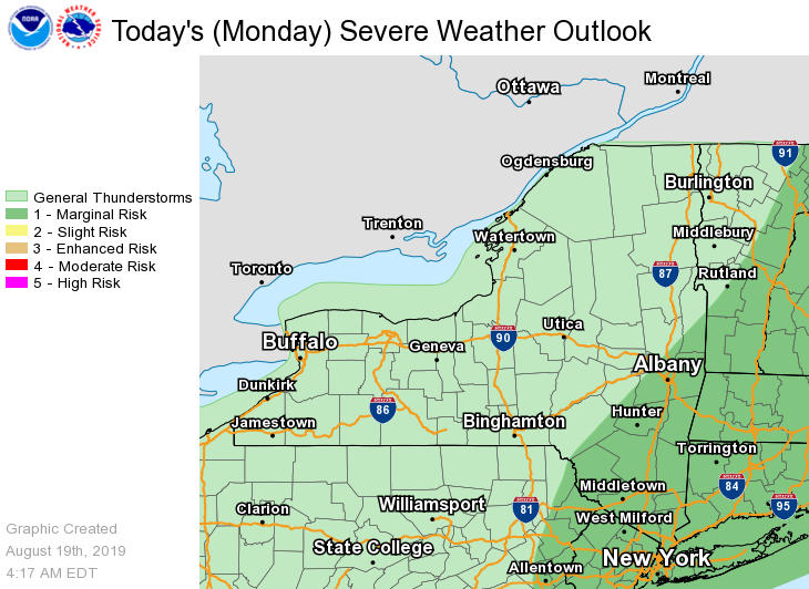
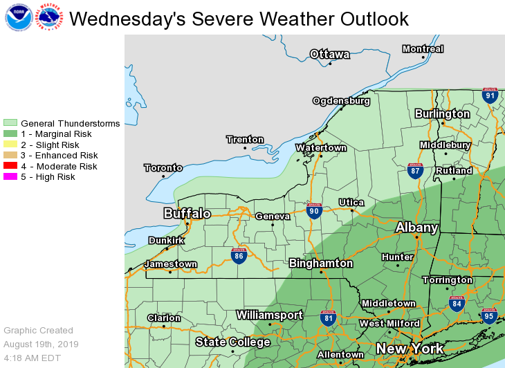
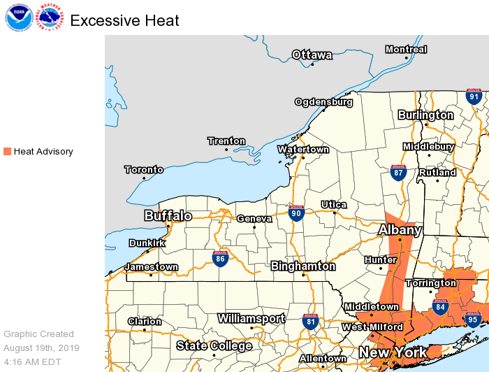
**** The information in this email pertains to the following areas only:**** *- In Connecticut: Litchfield County* *- In Massachusetts: Berkshire County* *- In Vermont: Bennington & Windham Counties* *- In New York: Albany, Columbia, Dutchess, Fulton, Hamilton, Herkimer, Montgomery, Greene, Rensselaer, Saratoga, Schenectady, Schoharie, Ulster, Warren and Washington Counties* Dear Emergency Managers and other partners, Scattered thunderstorms are possible this afternoon and evening, mainly from the Capital District of New York and points south and east. There is a Marginal Risk for severe thunderstorms, with isolated storms capable of producing damaging wind gusts and large hail. Locally heavy rainfall is also possible, which could result in minor urban and poor drainage flooding. Thunderstorms are likely on Wednesday, with a Marginal Risk for severe thunderstorms. Locally heavy rainfall will also be possible, which could result in minor urban and poor drainage flooding and isolated flash flooding. *Heat advisories have been issued* for the Hudson River Valley from the Capital District southward for today (in effect from 11 AM through 8 PM) as heat indices will reach between 95F and 100F. Please see the attached graphics for more details. If you have any questions, please feel free to contact us via: 1. Email: alb.stormreport@noaa.gov 2. NWSChat at https://nwschat.weather.gov/live/ 3. Social Media: Facebook <https://www.facebook.com/NWSAlbany> and Twitter <https://twitter.com/NWSAlbany> 4. Telephone: (518) 435-9575 <518-435-9575> Sincerely, NWS Albany www.weather.gov/albany