
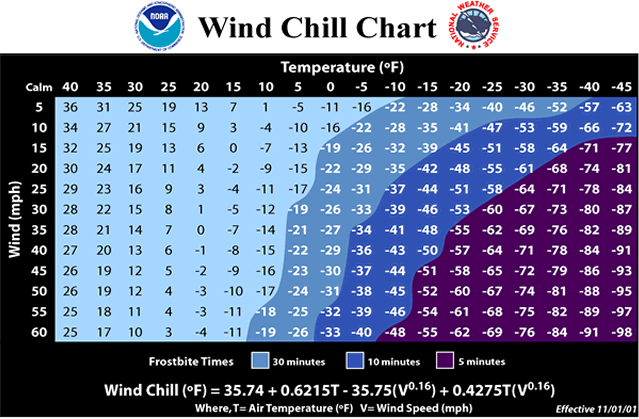
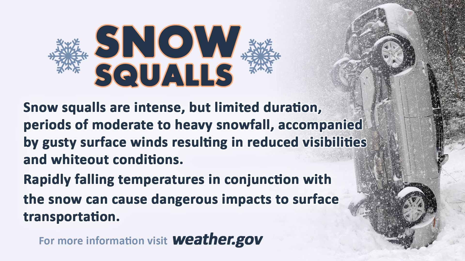
**** The information in this email pertains to the following areas only:**** *- In Connecticut: Litchfield County* *- In Massachusetts: Berkshire County* *- In Vermont: Bennington & Windham Counties* *- In New York: Albany, Columbia, Dutchess, Fulton, Hamilton, Herkimer, Montgomery, * * Greene, Rensselaer, Saratoga, Schenectady, Schoharie, Ulster, Warren and Washington * * Counties* Dear Emergency Managers and other partners, *Snow Squalls and Dangerous Wind Chill Potential for Wednesday and Wednesday Night.* Snow showers and scattered snow squalls are expected on Wednesday. Any snow squalls will produce near zero visibility, brief periods of heavy snow and *gusty winds* resulting in hazardous travel conditions. More information about snow squalls can be found here: https://www.weather.gov/safety/winter-snow-squall In addition, wind chill values may exceed 20 below zero late Wednesday night into early Thursday morning across parts of the western and southern Adirondacks. If confidence increases in dangerously low wind chills, then a Wind Chill Advisory would be issued. More information about wind chills can be found here: https://www.weather.gov/safety/cold If you have any questions, please feel free to contact us via: 1. Email: alb.stormreport@noaa.gov 2. NWSChat at https://nwschat.weather.gov/live/ 3. Social Media: Facebook <https://www.facebook.com/NWSAlbany> and Twitter <https://twitter.com/NWSAlbany> 4. Telephone: (518) 435-9575 <518-435-9575> Sincerely, NWS Albany www.weather.gov/albany