
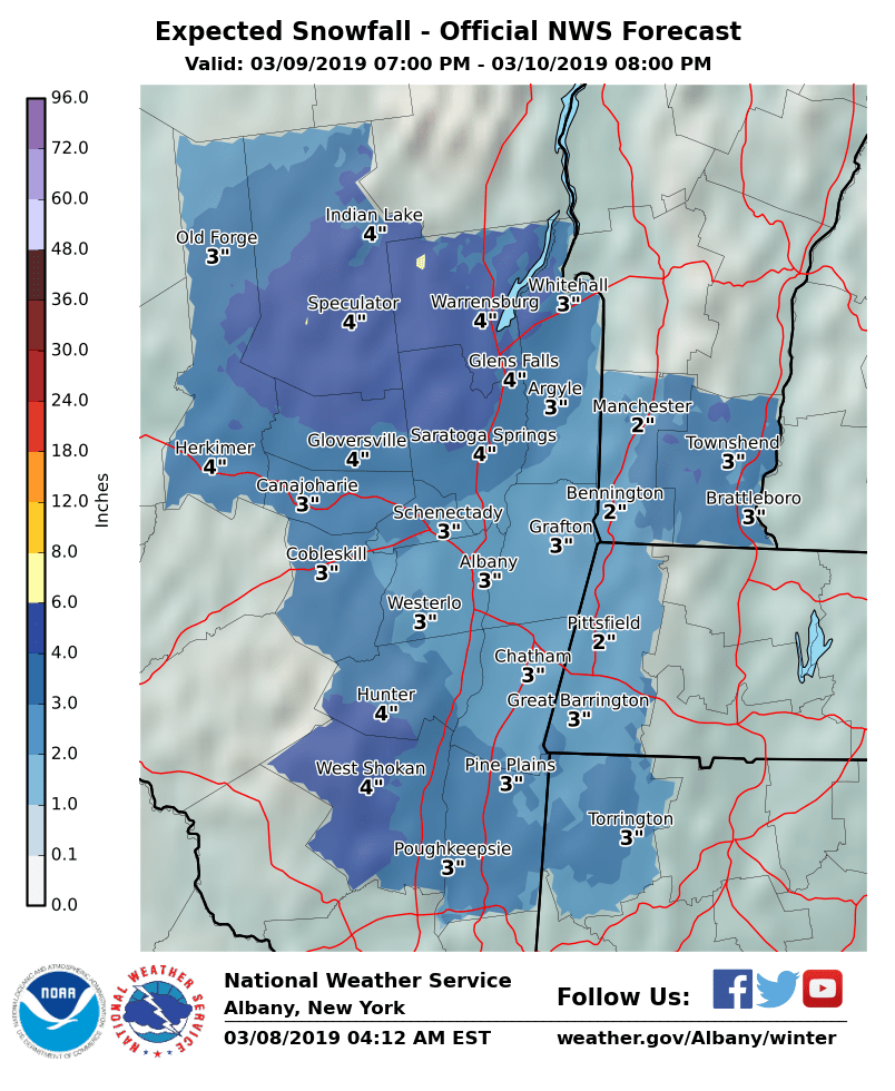
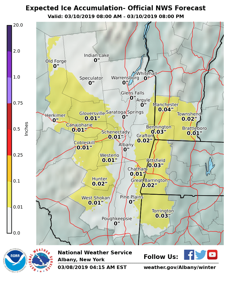
**** The information in this email pertains to the following areas only:**** *- In Connecticut: Litchfield County* *- In Massachusetts: Berkshire County* *- In Vermont: Bennington & Windham Counties* *- In New York: Albany, Columbia, Dutchess, Fulton, Hamilton, Herkimer, Montgomery, Greene, Rensselaer, Saratoga, Schenectady, Schoharie, Ulster, Warren and Washington Counties* Dear Emergency Managers and other partners, As a storm system approaches the region, light snow will develop Saturday night after midnight. The precipitation will change to sleet and possibly freezing rain after sunrise Sunday, before ending as plain rain showers during the day on Sunday. A light accumulation of snow is expected across the region (see the attached graphic for expected snowfall amounts) and some areas will also see a light glaze of ice. This wintry precipitation will make for hazardous driving and walking conditions late Saturday night into Sunday morning, especially for northern and high terrain areas. A Winter Weather Advisory may be needed for parts of the region. If you have any questions, please feel free to contact us via: 1. Email: alb.stormreport@noaa.gov 2. NWSChat at https://nwschat.weather.gov/live/ 3. Social Media: Facebook <https://www.facebook.com/NWSAlbany> and Twitter <https://twitter.com/NWSAlbany> 4. Telephone: (518) 435-9575 <518-435-9575> Sincerely, NWS Albany www.weather.gov/albany