
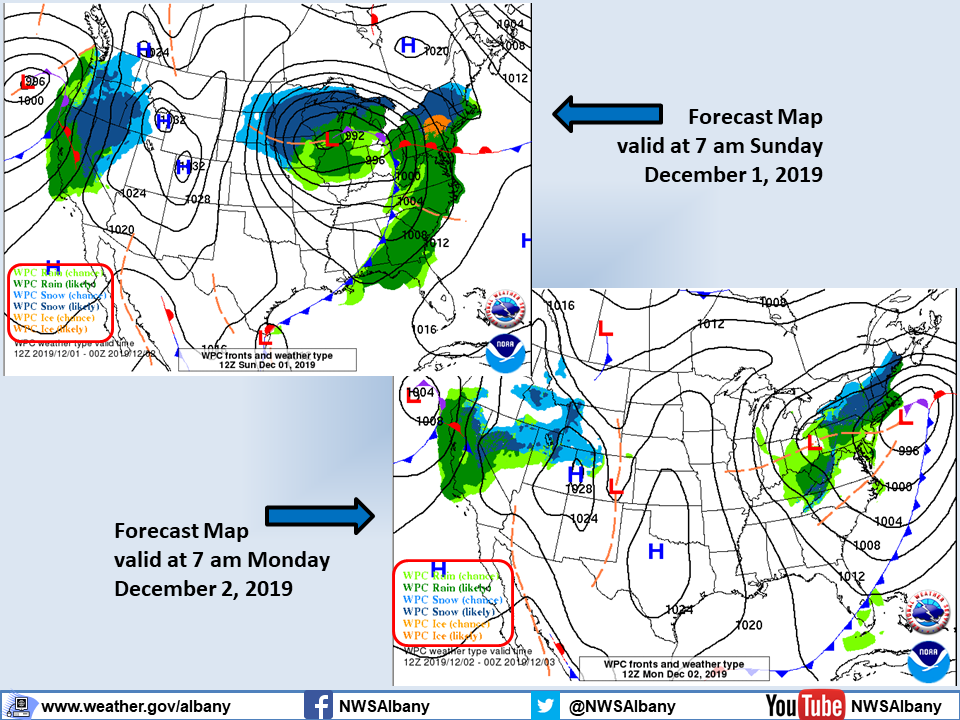
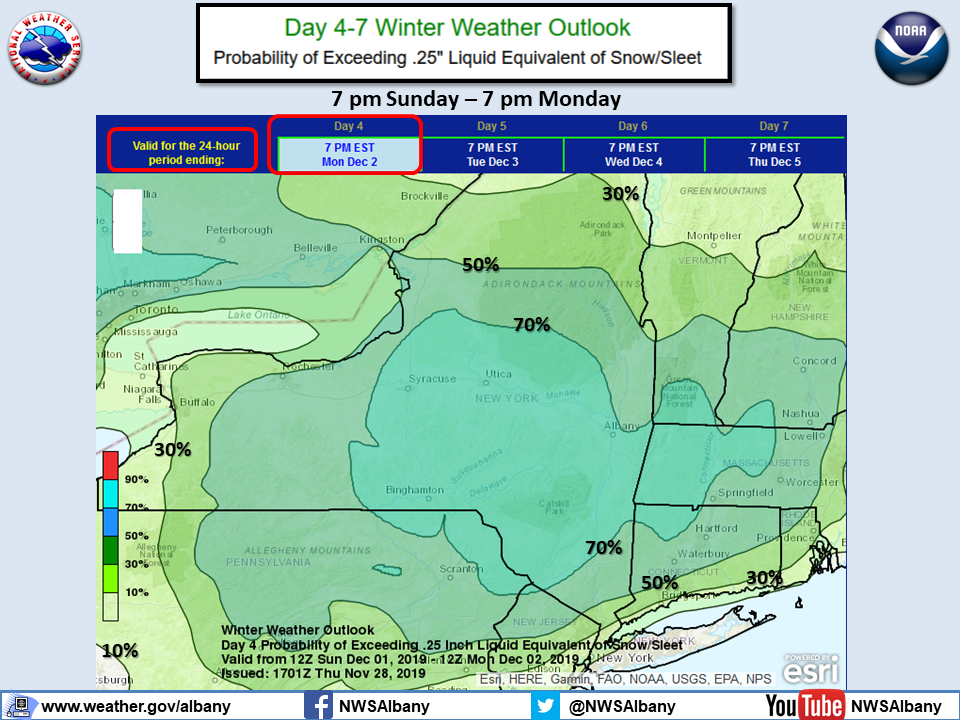
**** The information in this email pertains to the following areas only:**** *- In Connecticut: Litchfield County* *- In Massachusetts: Berkshire County* *- In Vermont: Bennington & Windham Counties* *- In New York: Albany, Columbia, Dutchess, Fulton, Hamilton, Herkimer, Montgomery, Greene, Rensselaer, Saratoga, Schenectady, Schoharie, Ulster, Warren and Washington Counties* Dear Emergency Managers and other partners, A slow moving storm system will bring snow and possibly a wintry mix to the region for Sunday into Monday. Travel impacts due to snow covered roads and reduced visibility are likely Sunday afternoon into Monday. At this time, a light to moderate snowfall is possible across east central New York and western New England during the day Sunday with snow continuing into Monday. Mixed precipitation possible Sunday night south of the Capital District including across northwestern Connecticut into the Berkshires. There are still uncertainties in the forecast which impact expected snowfall amounts and where mixed precipitation will occur. If you have any questions, please feel free to contact us via: 1. Email: alb.stormreport@noaa.gov 2. NWSChat at https://nwschat.weather.gov/live/ 3. Social Media: Facebook <https://www.facebook.com/NWSAlbany> and Twitter <https://twitter.com/NWSAlbany> 4. Telephone: (518) 435-9575 <518-435-9575> Sincerely, NWS Albany www.weather.gov/albany