
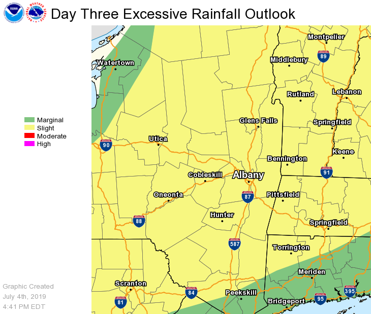
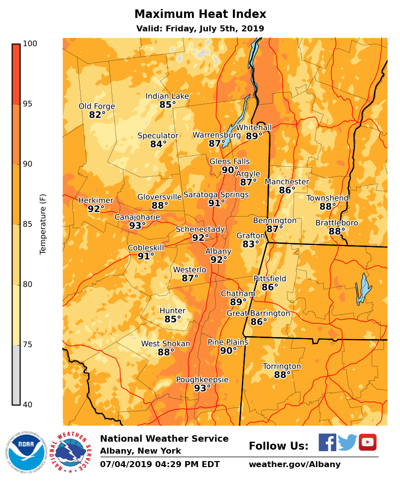
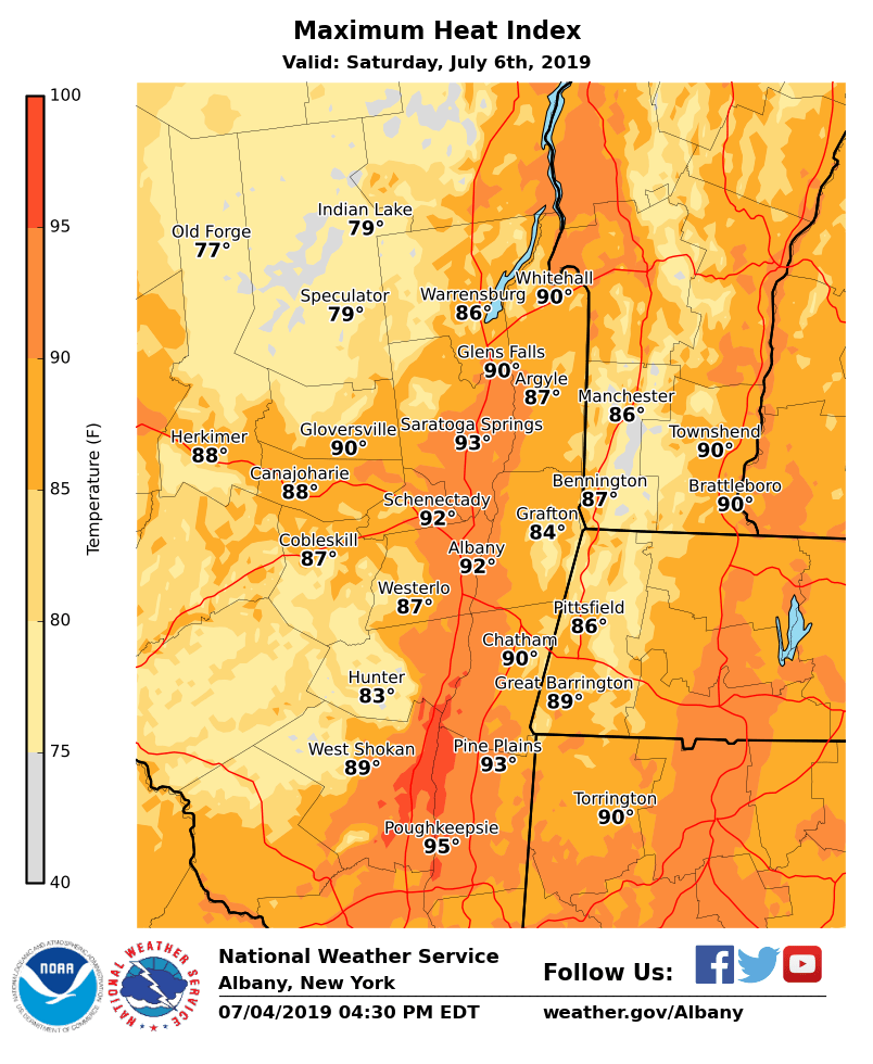
**** The information in this email pertains to the following areas only:**** *- In Connecticut: Litchfield County* *- In Massachusetts: Berkshire County* *- In Vermont: Bennington & Windham Counties* *- In New York: Albany, Columbia, Dutchess, Fulton, Hamilton, Herkimer, Montgomery, Greene, Rensselaer, Saratoga, Schenectady, Schoharie, Ulster, Warren and Washington Counties* Dear Emergency Managers and other partners, The combination of hot temperatures and increasing humidity levels may produce dangerous heat conditions with heat indices in the low to mid-90s in portions of the Capital District and Mid-Hudson Valley Friday and Saturday. If confidence increases in heat indices of 95F or greater, a Heat Advisory will be necessary. In addition, isolated to scattered showers and thunderstorms are expected Friday afternoon and evening mainly west of the Hudson Valley, becoming numerous to widespread areawide on Saturday. Heavy downpours are likely in any thunderstorm. Urban and poor drainage flooding and isolated flash flooding is possible, especially on Saturday. If you have any questions, please feel free to contact us via: 1. Email: alb.stormreport@noaa.gov 2. NWSChat at https://nwschat.weather.gov/live/ 3. Social Media: Facebook <https://www.facebook.com/NWSAlbany> and Twitter <https://twitter.com/NWSAlbany> 4. Telephone: (518) 435-9575 <518-435-9575> Sincerely, NWS Albany www.weather.gov/albany