
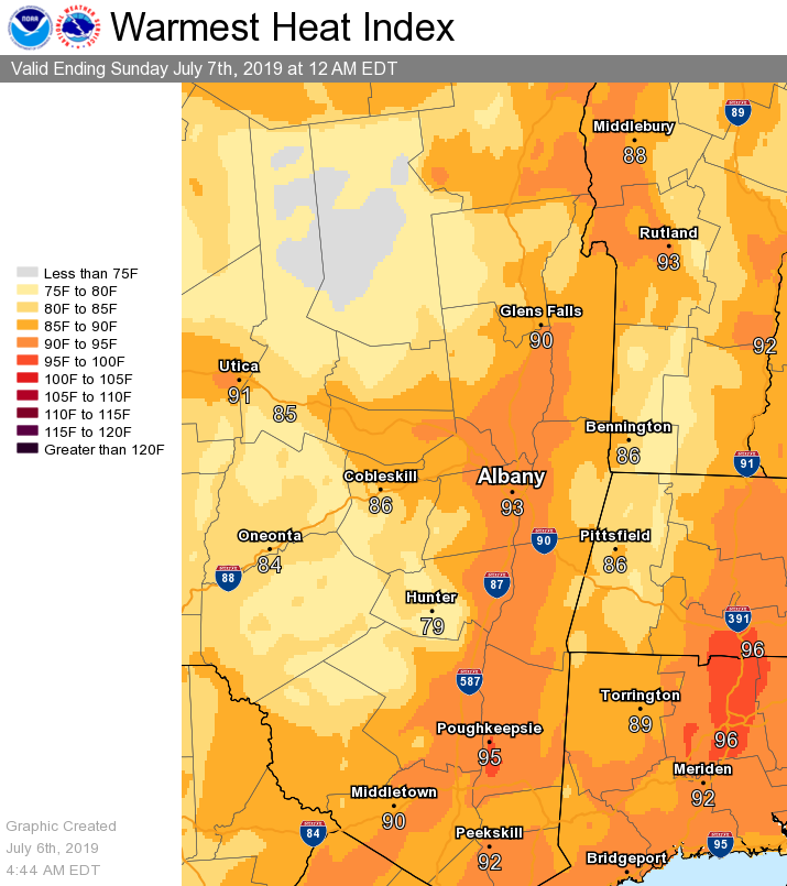
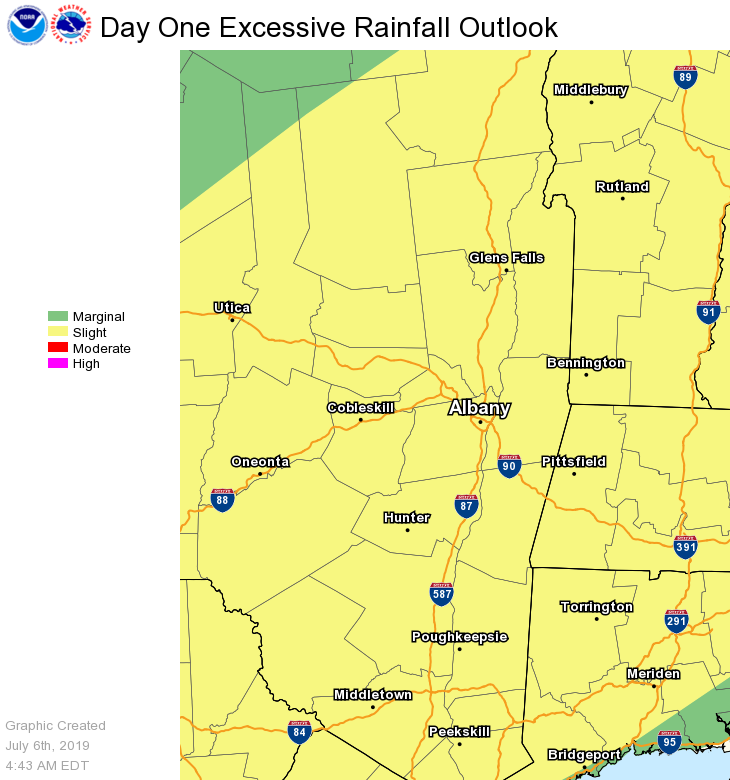
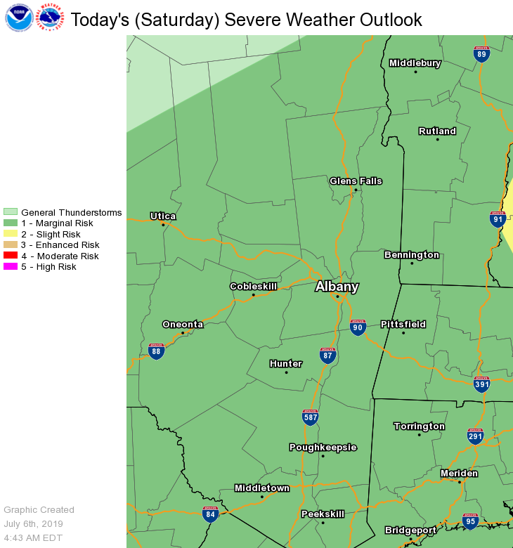
**** The information in this email pertains to the following areas only:**** *- In Connecticut: Litchfield County* *- In Massachusetts: Berkshire County* *- In Vermont: Bennington & Windham Counties* *- In New York: Albany, Columbia, Dutchess, Fulton, Hamilton, Herkimer, Montgomery, Greene, Rensselaer, Saratoga, Schenectady, Schoharie, Ulster, Warren and Washington Counties* Dear Emergency Managers and other partners, The combination of hot temperatures and high humidity levels will allow for heat index values to reach into the low to middle 90s today during the afternoon hours. See the attached graphic for details on how high the heat index is expected to reach across the area. Anyone outdoors for an extended period of time is vulnerable to heat illness. Heat safety info from the NWS website can be found here: https://www.weather.gov/safety/heat As a frontal boundary approaches, showers and thunderstorms will become widespread this afternoon into this evening. Any shower or thunderstorm will be capable of producing very heavy downpours, which may result in urban and poor drainage flooding. If multiple storms pass over the same area, flash flooding is possible as well. The excessive rainfall outlook is attached to this email. Although widespread severe thunderstorms are not expected, a few thunderstorms could contain gusty winds. There is a marginal risk for severe thunderstorms for the entire area for this afternoon into this evening. If you have any questions, please feel free to contact us via: 1. Email: alb.stormreport@noaa.gov 2. NWSChat at https://nwschat.weather.gov/live/ 3. Social Media: Facebook <https://www.facebook.com/NWSAlbany> and Twitter <https://twitter.com/NWSAlbany> 4. Telephone: (518) 435-9575 <518-435-9575> Sincerely, NWS Albany www.weather.gov/albany