
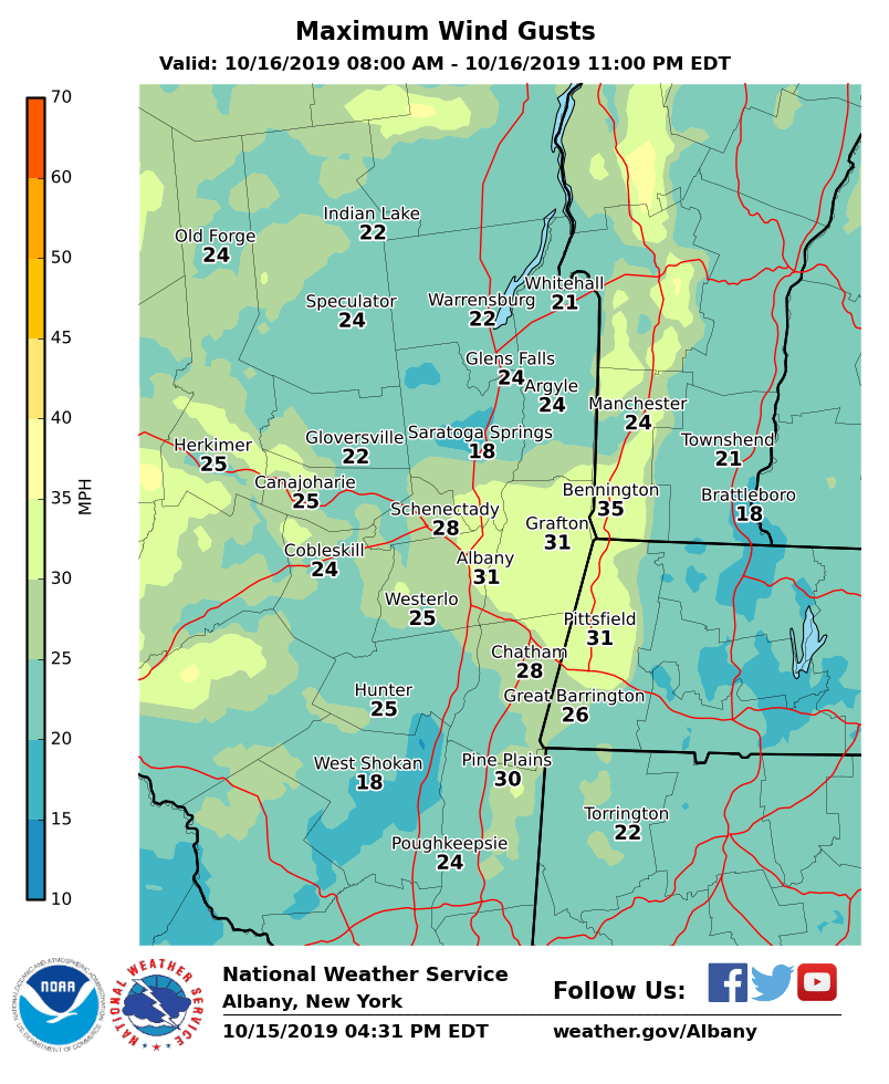
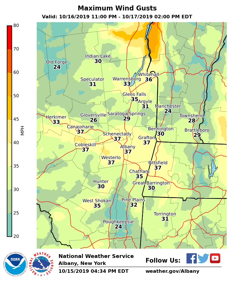
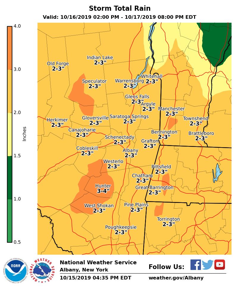
**** The information in this email pertains to the following areas only:**** *- In Connecticut: Litchfield County* *- In Massachusetts: Berkshire County* *- In Vermont: Bennington & Windham Counties* *- In New York: Albany, Columbia, Dutchess, Fulton, Hamilton, Herkimer, Montgomery, Greene, Rensselaer, Saratoga, Schenectady, Schoharie, Ulster, Warren and Washington Counties* Dear Emergency Managers and other partners, A widespread soaking rainfall is expected Wednesday afternoon into Thursday along with gusty winds. Total rainfall for this event is expected to be 2 - 3 inches with locally higher amounts possible in the eastern Catskills. The rainfall may become locally heavy at times which may yield some poor drainage flooding of low lying areas, and ponding of water on roadways. Leaves and debris could also clog drains and produce some nuisance flooding. Southeast winds could gust to 30 - 35 mph Wednesday evening before turning out of the northwest and increasing in strength. Wind gusts on Thursday could exceed 40 mph with some localized wind gusts approaching 50 mph. If confidence increases for damaging winds, a wind advisory may be needed. Please see attached forecast graphics for total rainfall as well as maximum wind gusts for this event. If you have any questions, please feel free to contact us via: 1. Email: alb.stormreport@noaa.gov 2. NWSChat at https://nwschat.weather.gov/live/ 3. Social Media: Facebook <https://www.facebook.com/NWSAlbany> and Twitter <https://twitter.com/NWSAlbany> 4. Telephone: (518) 435-9575 <518-435-9575> Sincerely, NWS Albany www.weather.gov/albany