
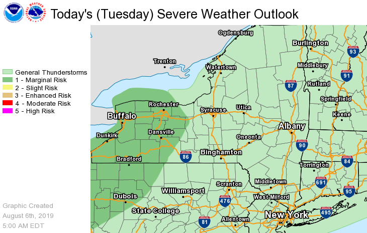
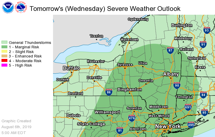
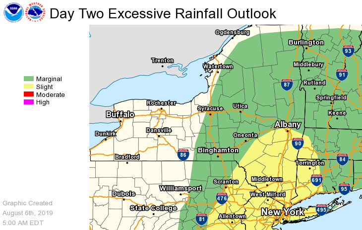
Dear Emergency Managers and other partners, Multiple upper level disturbances and frontal systems will move across the region this afternoon through Thursday, bringing several rounds of showers and thunderstorms. The thunderstorms this afternoon into early this evening are not expected to be severe, but an isolated stronger thunderstorm with damaging winds can not be ruled out. There is a Marginal Risk for Severe Thunderstorms for Wednesday afternoon/evening for most of eastern New York and adjacent western New England. The main threat from these thunderstorms would be damaging wind gusts. Also, heavy rainfall could lead to ponding of water in low lying, urban and poor drainage areas, especially Wednesday into Wednesday night. An isolated flash flood is possible, and the latest WPC Excessive Rainfall graphic has a Marginal to Slight Risk of exceeding the flash flood guidance across the forecast area. Scattered thunderstorms could occur once again Thursday afternoon and evening, some of which could contain strong wind gusts. Please refer to the attached images for additional information. If you have any questions, please feel free to contact us via: 1. Email: alb.stormreport@noaa.gov 2. NWSChat at https://nwschat.weather.gov/live/ 3. Social Media: Facebook <https://www.facebook.com/NWSAlbany> and Twitter <https://twitter.com/NWSAlbany> 4. Telephone: (518) 435-9575 <518-435-9575> Sincerely, NWS Albany www.weather.gov/albany