
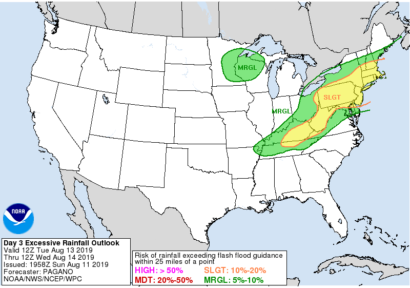
**** The information in this email pertains to the following areas only:**** *- In Connecticut: Litchfield County* *- In Massachusetts: Berkshire County* - In New York: Columbia, Dutchess, Greene, Ulster Dear Emergency Managers and other partners, Locally heavy rain and embedded thunderstorms are expected along a frontal system Tuesday, mainly from the eastern Catskills, through the mid Hudson Valley, Berkshires and Litchfield Hills. These areas are under a slight risk of excessive rainfall, where urban and small stream flooding is possible, along with isolated flash flooding. Please refer to the attached graphic for an outline of the areas with the greatest threat for excessive rainfall. If you have any questions, please feel free to contact us via: 1. Email: alb.stormreport@noaa.gov 2. NWSChat at https://nwschat.weather.gov/live/ 3. Social Media: Facebook <https://www.facebook.com/NWSAlbany> and Twitter <https://twitter.com/NWSAlbany> 4. Telephone: (518) 435-9575 <518-435-9575>