
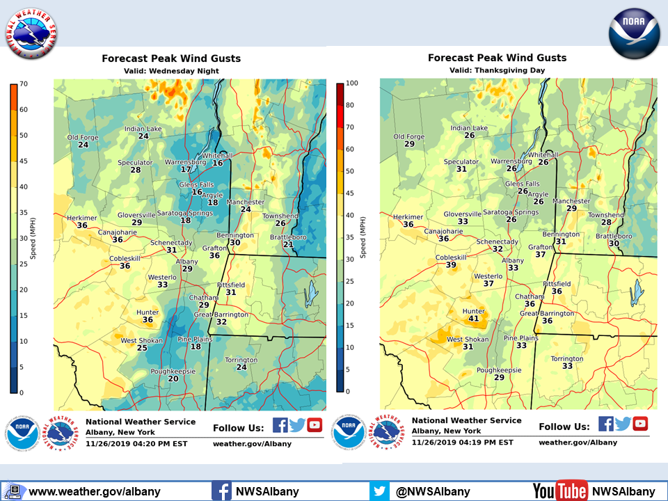
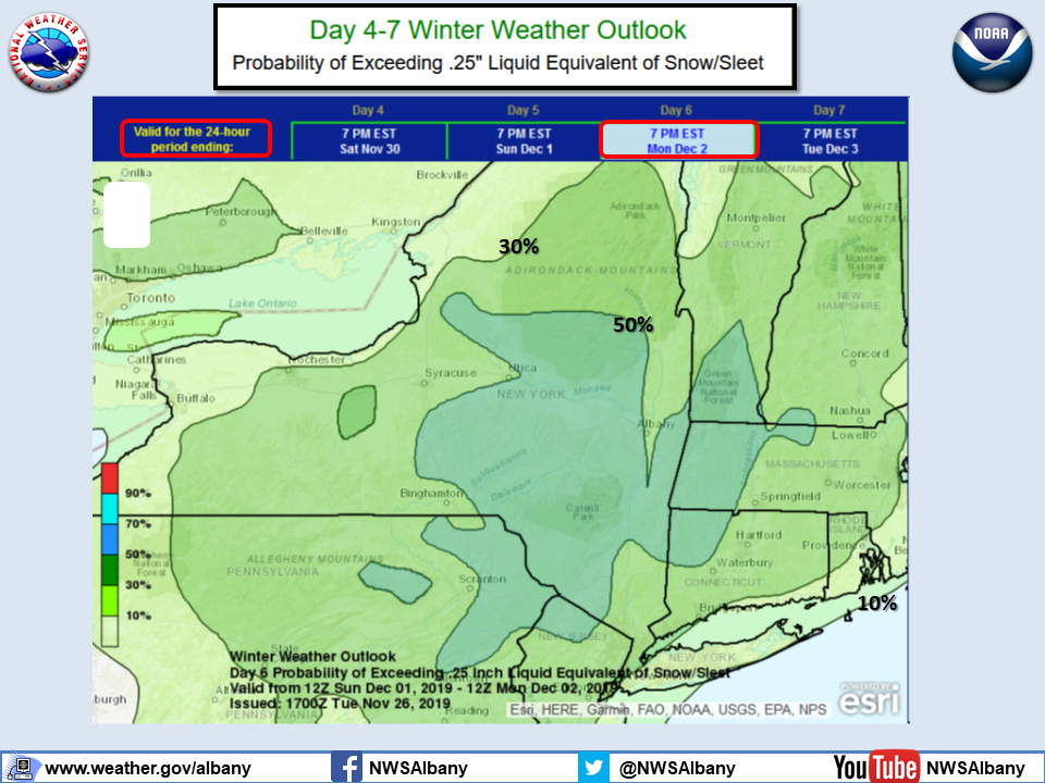
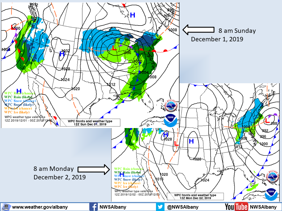
**** The information in this email pertains to the following areas only:**** *- In Connecticut: Litchfield County* *- In Massachusetts: Berkshire County* *- In Vermont: Bennington & Windham Counties* *- In New York: Albany, Columbia, Dutchess, Fulton, Hamilton, Herkimer, Montgomery, Greene, Rensselaer, Saratoga, Schenectady, Schoharie, Ulster, Warren and Washington Counties* Dear Emergency Managers and other partners, Strong and gusty west to northwest winds are expected Wednesday night into Thanksgiving Day with gusts of 35 to 45 mph. If wind gusts in excess of 45 mph are expected then a wind advisory will be issued. Please refer to the attached slide "PeakWindGusts" for details. A wintry mix of precipitation is possible Sunday into Monday. Uncertainty continues regarding start time of precipitation, and overall track/evolution of this storm system. Please refer to the attached slide "Outlook_Snow_Sleet" for the possibility for a plowable snowfall and "ForecastMaps" for the expected track of the storm. If you have any questions, please feel free to contact us via: 1. Email: alb.stormreport@noaa.gov 2. NWSChat at https://nwschat.weather.gov/live/ 3. Social Media: Facebook <https://www.facebook.com/NWSAlbany> and Twitter <https://twitter.com/NWSAlbany> 4. Telephone: (518) 435-9575 <518-435-9575> Sincerely, NWS Albany www.weather.gov/albany