NWS Albany - Winter Weather and Snow Potential this Weekend - Issued 5:00 AM Friday, January 3, 2020

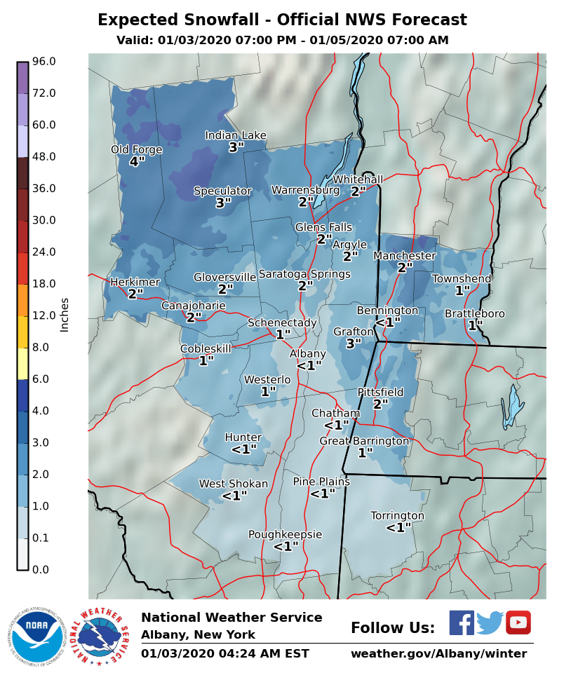
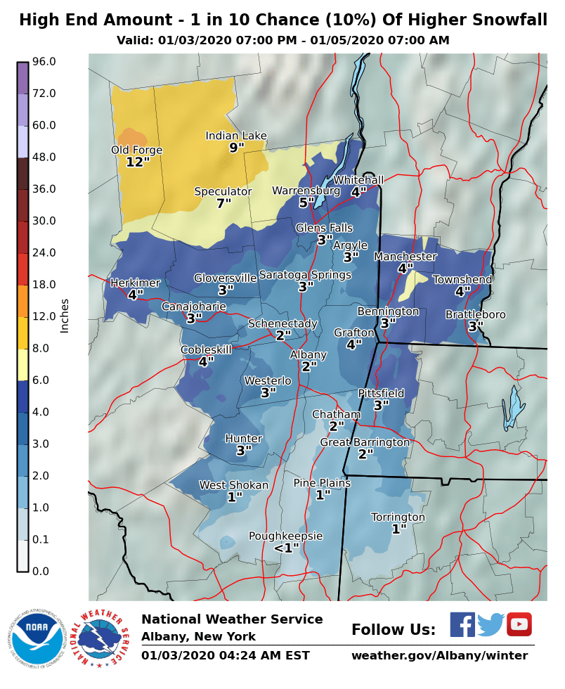
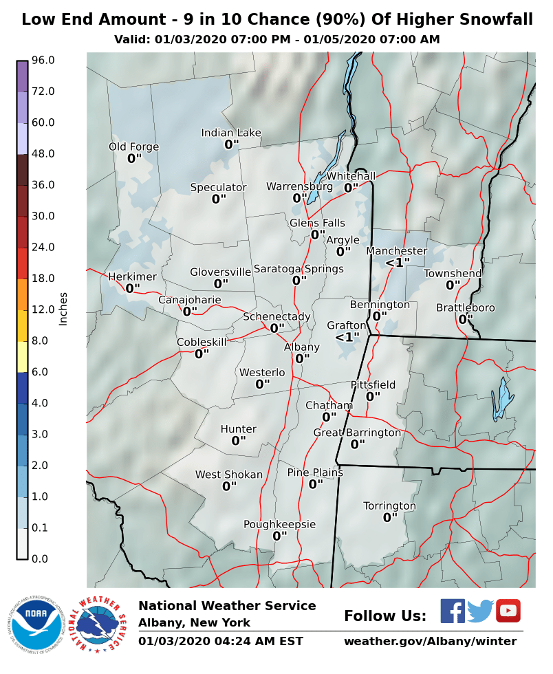
**** The information in this email pertains to the following areas only:**** *- In Vermont: Bennington & Windham Counties* *- In New York: Albany, Columbia, Dutchess, Fulton, Hamilton, Herkimer, Montgomery, Greene, Rensselaer, Saratoga, Schenectady, Schoharie, Ulster, Warren and Washington Counties* *- In Massachusetts: Berkshire County* *- In Connecticut: Litchfield County* Dear Emergency Managers and other partners, A complex storm system will impact the region over the weekend. Rain and high terrain snow Saturday may transition to all snow Saturday night into Sunday morning with light to moderate wet snow accumulations possible. Winter weather headlines may be needed, mainly for the higher terrain such as the southern Adirondacks, southern Greens, and Berkshires. Please see the attached graphics showing the expected, low end, and high end snowfall totals. Confidence is increasing that another storm system may bring a widespread accumulating snowfall Tuesday night into Wednesday. If you have any questions, please feel free to contact us via: 1. Email: alb.stormreport@noaa.gov 2. NWSChat at https://nwschat.weather.gov/live/ 3. Social Media: Facebook <https://www.facebook.com/NWSAlbany> and Twitter <https://twitter.com/NWSAlbany> 4. Telephone: (518) 435-9575 <518-435-9575> Sincerely, NWS Albany www.weather.gov/albany
participants (1)
-
 ALB Stormreport - NOAA Service Account