NWS Albany - Thunderstorm potential - Tuesday through Thursday - issued August 5, 2019 at 445 PM EDT

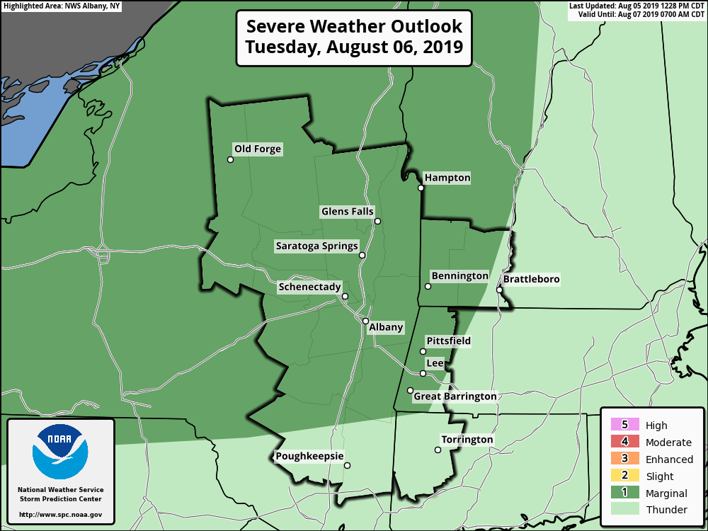
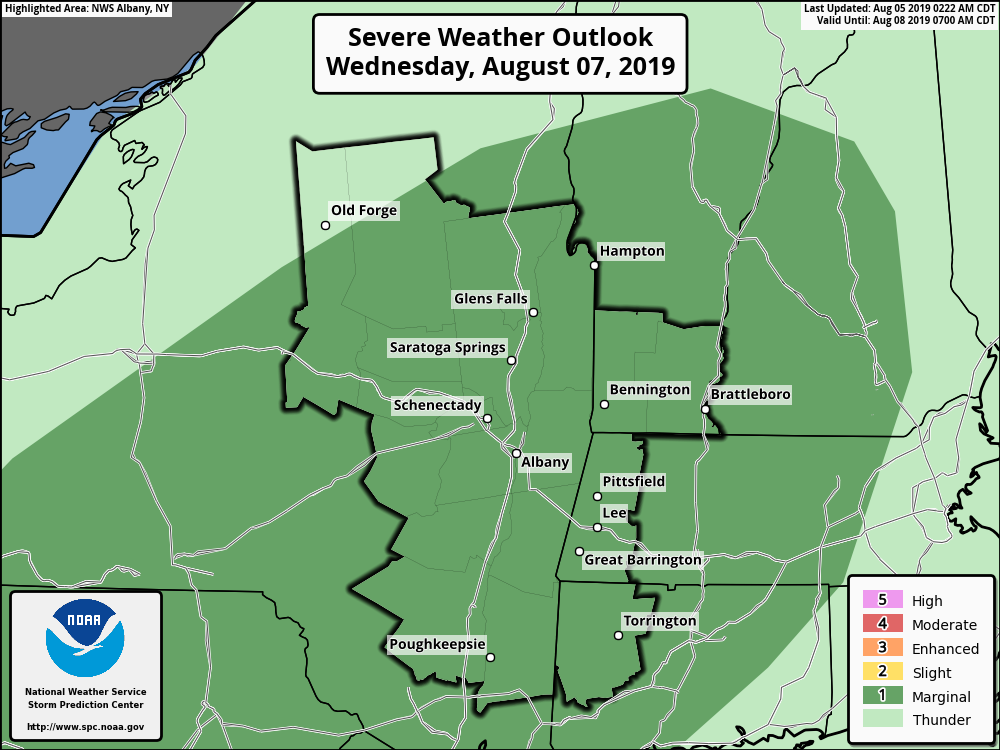
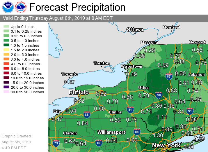
**** The information in this email pertains to the following areas only:**** *- In Connecticut: Litchfield County* *- In Massachusetts: Berkshire County* *- In Vermont: Bennington & Windham Counties* *- In New York: Albany, Columbia, Dutchess, Fulton, Hamilton, Herkimer, Montgomery, Greene, Rensselaer, Saratoga, Schenectady, Schoharie, Ulster, Warren and Washington Counties* Dear Emergency Managers and other partners, Multiple upper level disturbances and frontal systems will move across the region Tuesday afternoon through Thursday, bringing several rounds of showers and thunderstorms. There is a Marginal Risk for Severe Thunderstorms for Tuesday afternoon/evening, and again Wednesday afternoon/evening for most of eastern New York and adjacent western New England. The main threat from these thunderstorms would be damaging wind gusts. Also, heavy rainfall could lead to ponding of water in low lying, urban and poor drainage areas, especially Wednesday into Wednesday night. Isolated flash flooding is possible. Scattered thunderstorms could occur once again Thursday afternoon and evening, some of which could contain strong wind gusts. Please refer to the attached images for additional information. If you have any questions, please feel free to contact us via: 1. Email: alb.stormreport@noaa.gov 2. NWSChat at https://nwschat.weather.gov/live/ 3. Social Media: Facebook <https://www.facebook.com/NWSAlbany> and Twitter <https://twitter.com/NWSAlbany> 4. Telephone: (518) 435-9575 <518-435-9575> Sincerely, NWS Albany www.weather.gov/albany
participants (1)
-
 ALB Stormreport - NOAA Service Account