NWS Albany - Marginal Risk For Severe Thunderstorms Today - Sunday, August 18, 2019 445 AM

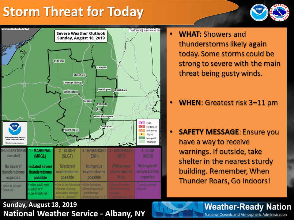
**** The information in this email pertains to the following areas only:**** *- In Connecticut: Litchfield County* *- In Massachusetts: Berkshire County* *- In Vermont: Bennington & Windham Counties* *- In New York: Albany, Columbia, Dutchess, Fulton, Hamilton, Herkimer, Montgomery, Greene, Rensselaer, Saratoga, Schenectady, Schoharie, Ulster, Warren and Washington Counties* Dear Emergency Managers and other partners, Thunderstorms will be likely again today. There is a marginal risk for severe thunderstorms with the main threat being damaging wind gusts. Any thunderstorm will be capable of locally heavy rainfall which may lead to urban and poor drainage flooding. An isolated flash flood is also possible. The main threat for severe thunderstorms is 3-11 pm. There is a chance of thunderstorms Monday afternoon and evening, and also on Wednesday. Any thunderstorm will be capable of gusty winds and locally heavy rainfall. Heat advisories may be needed in the Hudson River Valley Monday as heat indices may exceed 95F. Please see the attached severe weather outlook graphic for today. If you have any questions, please feel free to contact us via: 1. Email: alb.stormreport@noaa.gov 2. NWSChat at https://nwschat.weather.gov/live/ 3. Social Media: Facebook <https://www.facebook.com/NWSAlbany> and Twitter <https://twitter.com/NWSAlbany> 4. Telephone: (518) 435-9575 <518-435-9575> Sincerely, NWS Albany www.weather.gov/albany
participants (1)
-
 ALB Stormreport - NOAA Service Account