NWS Albany - Threat For Severe Thunderstorms Today and Heat Advisory on Monday - Issued Sunday, August 18, 2019 555 PM

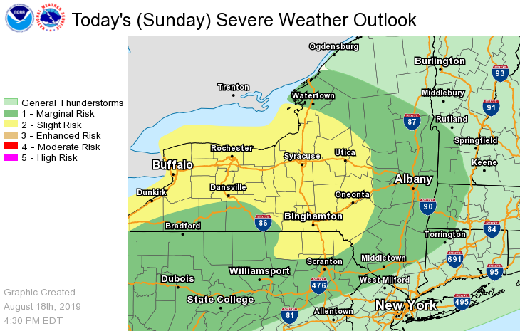
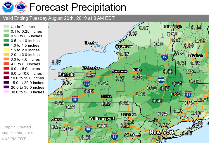
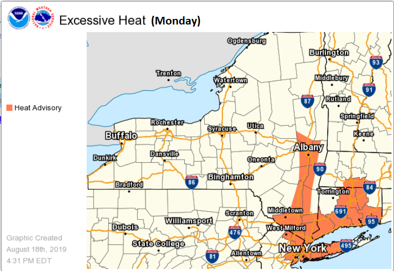
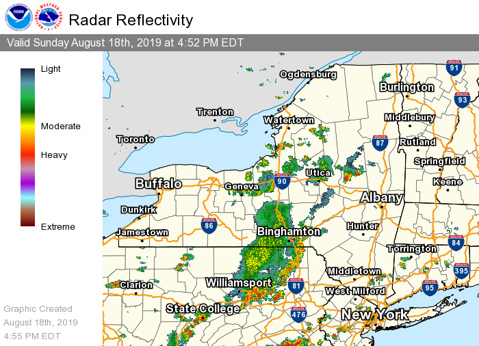
**** The information in this email pertains to the following areas only:**** *- In Connecticut: Litchfield County* *- In Massachusetts: Berkshire County* *- In Vermont: Bennington & Windham Counties* *- In New York: Albany, Columbia, Dutchess, Fulton, Hamilton, Herkimer, Montgomery, Greene, Rensselaer, Saratoga, Schenectady, Schoharie, Ulster, Warren and Washington Counties* Dear Emergency Managers and other partners, Thunderstorms have developed this afternoon from the southwestern Adirondacks to the Southern Tier of New York and will be moving eastward this evening. Also, storms are developing over the mid Hudson Valley into northwest Connecticut. Some of these storms will likely become severe with damaging winds and possibly some hail around 1 inch. Any thunderstorm will be capable of locally heavy rainfall which may lead to urban and poor drainage flooding. An isolated flash flood is also possible. The main threat for severe thunderstorms is through 11 pm. There is a chance of thunderstorms Monday afternoon and evening, and also on Wednesday. Any thunderstorm will be capable of gusty winds and locally heavy rainfall. *Heat advisories have been issued* for the Hudson River Valley from the Capital District southward for Monday as heat indices will exceed 95F and approach 100F. Please see the attached graphics. If you have any questions, please feel free to contact us via: 1. Email: alb.stormreport@noaa.gov 2. NWSChat at https://nwschat.weather.gov/live/ 3. Social Media: Facebook <https://www.facebook.com/NWSAlbany> and Twitter <https://twitter.com/NWSAlbany> 4. Telephone: (518) 435-9575 <518-435-9575> Sincerely, NWS Albany www.weather.gov/albany
participants (1)
-
 ALB Stormreport - NOAA Service Account