Severe Thunderstorms Potential Wednesday Sept 4, 2019 - Update 4:30PM Tuesday Sept 3, 2019

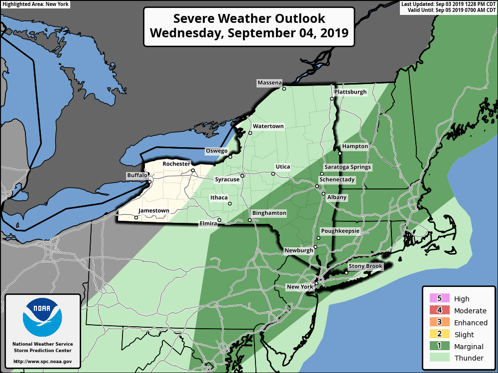
**** The information in this email pertains to the following areas only:**** *- In Connecticut: Litchfield County* *- In Massachusetts: Berkshire County* *- In Vermont: Bennington & Windham Counties* *- In New York: Albany, Columbia, Dutchess, Fulton, Hamilton, Herkimer, Montgomery, Greene, Rensselaer, Saratoga, Schenectady, Schoharie, Ulster, Warren and Washington Counties* Dear Emergency Managers and other partners, Please be aware there is potential for severe thunderstorms tomorrow from midday until late afternoon as a cold front moves through the region. Most thunderstorms should exit into New England by sunset. The primary concern with any severe thunderstorm is damaging winds but hail and heavy downpours are also possible. Areas from the Lake George/Saratoga region, the Greater Capital District, western New England, eastern Catskills and the mid-Hudson Valley have the greatest potential for severe storms. See the attached graphic for more information. If you have any questions, please feel free to contact us via: 1. Email: alb.stormreport@noaa.gov 2. NWSChat at https://nwschat.weather.gov/live/ 3. Social Media: Facebook <https://www.facebook.com/NWSAlbany> and Twitter <https://twitter.com/NWSAlbany> 4. Telephone: (518) 435-9575 <518-435-9575> Sincerely, NWS Albany www.weather.gov/albany
participants (1)
-
 ALB Stormreport - NOAA Service Account