NWS Albany - Wintry Mix Expected Thursday Night into Friday Morning - Wednesday, December 26th, 2018 - 430 AM

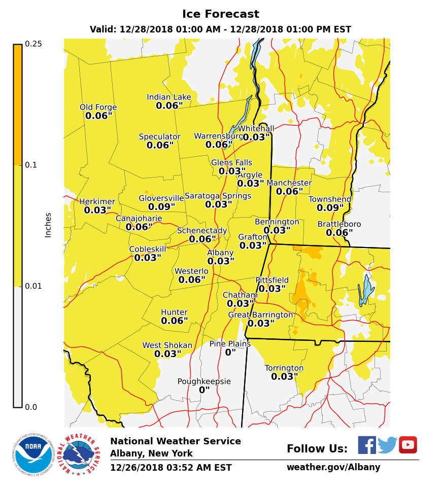
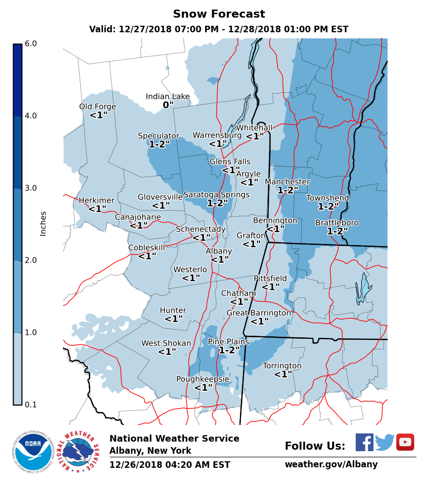
**** The information in this email pertains to the following areas only:**** *- In Connecticut: Litchfield County* *- In Massachusetts: Berkshire County* *- In Vermont: Bennington & Windham Counties* *- In New York: Albany, Columbia, Dutchess, Fulton, Hamilton, Herkimer, Montgomery, Greene, Rensselaer, Saratoga, Schenectady, Schoharie, Ulster, Warren and Washington Counties* Dear Emergency Managers and Other Partners, A storm system will be impacting the region for Thursday night into Friday. Precipitation will begin around midnight and initially be snow and sleet, but will quickly change to freezing rain during the late night hours. As temperatures continue to rise, precipitation will change to plain rain between 4 AM and 10 AM on Friday with the Adirondacks and southern Vermont taking the longest to changeover to plain rain. Across the entire area, snow and sleet accumulation will be an inch or less, along with a light glaze of ice. This wintry mix will make for hazardous driving and walking conditions, including during parts of the Friday morning commute. Attached is our current forecast amounts for snow and ice. If you have any questions, please feel free to contact us via: 1. Email: alb.stormreport@noaa.gov 2. NWSChat at https://nwschat.weather.gov/live/ 3. Social Media: Facebook <https://www.facebook.com/NWSAlbany> and Twitter <https://twitter.com/NWSAlbany> 4. Telephone: (518) 435-9575 <518-435-9575> Sincerely, NWS Albany www.weather.gov/albany
participants (1)
-
 ALB Stormreport - NOAA Service Account