
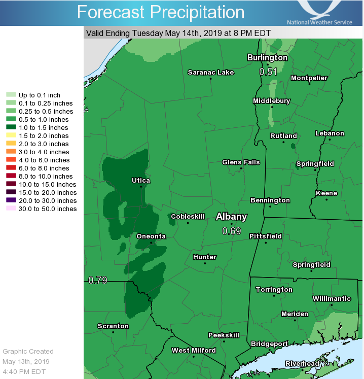
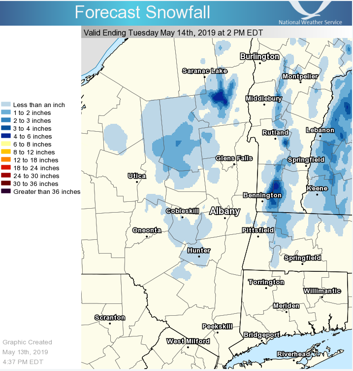
**** The information in this email pertains to the following areas only:**** *- In Connecticut: Litchfield County* *- In Massachusetts: Berkshire County* *- In Vermont: Bennington & Windham Counties* *- In New York: Albany, Columbia, Dutchess, Fulton, Hamilton, Herkimer, Montgomery, Greene, Rensselaer, Saratoga, Schenectady, Schoharie, Ulster, Warren and Washington Counties* Dear Emergency Managers and other partners, Rain will mix with or change to snow over higher elevations tonight. Snow accumulations will be mainly confined to areas above 1000 feet above sea level, with no snow accumulations expected at lower elevations including the Hudson and Mohawk Valleys. However, snowfall accumulations of around an inch will be possible by mid-morning tomorrow above 1000 feet in the Catskills, Helderbergs, Taconics, Berkshires, Green Mountains and Adirondacks, with as much as 4 inches above 2000 feet. Most of the accumulations will be on grassy or elevated surfaces, however some roadways will become slick, especially above 2000 feet. Rainfall totals with this storm will average 0.5 to 1.0 inch across the area, with a little more possible in the Catskills. This is not enough to cause any significant flooding. Attached are forecasts for snowfall and rainfall across the area through midday Tuesday. If you have any questions, please feel free to contact us via: 1. Email: alb.stormreport@noaa.gov 2. NWSChat at https://nwschat.weather.gov/live/ 3. Social Media: Facebook <https://www.facebook.com/NWSAlbany> and Twitter <https://twitter.com/NWSAlbany> 4. Telephone: (518) 435-9575 <518-435-9575> Sincerely, NWS Albany www.weather.gov/albany
participants (1)
-
 ALB Stormreport - NOAA Service Account