
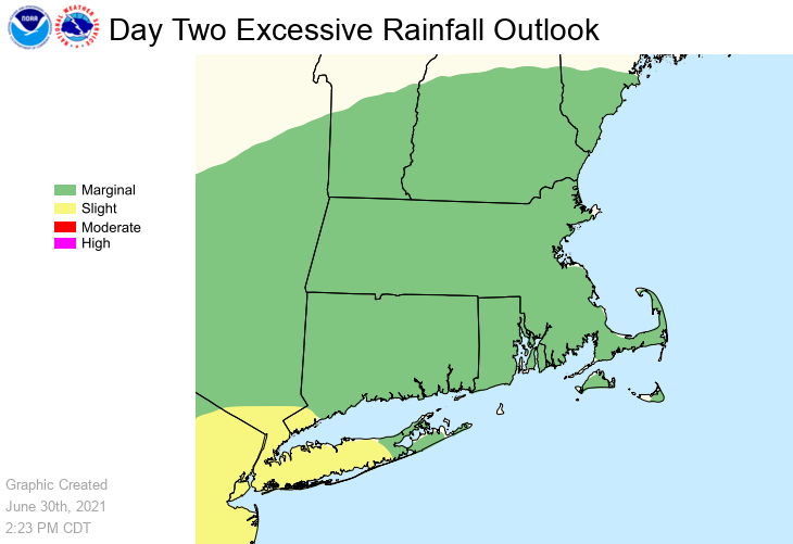
All, A Severe Thunderstorm Watch is in effect for much of MA, RI and CT until 10 pm EDT Wednesday. Scattered severe thunderstorms are likely with damaging wind gusts up to 70 mph. Storms will be most numerous across northern Massachusetts (including the Greater Boston area) and adjacent sections of CT & RI. Storms will be less numerous southward toward the coast and Islands, including Cape Cod. Isolated up to quarter size hail is also possible. Tomorrow (Thursday) into tomorrow night, weather concerns shift toward heavy rain with a localized flood threat mainly across CT, RI and south of the Massachusetts Turnpike. Also, isolated severe thunderstorms with winds in excess of 60 mph are possible. If you have any questions or would like more information, don't hesitate to contact us via this email address, on NWSChat <https://nwschat.weather.gov/>, or at the following: Frank Nocera National Weather Service Boston/Norton, MA 46 Commerce Way Norton, MA 02766 508.622.3280 Website <http://www.weather.gov/boston> | Facebook <http://www.facebook.com/NWSBoston> | Twitter <http://www.twitter.com/NWSBoston>