
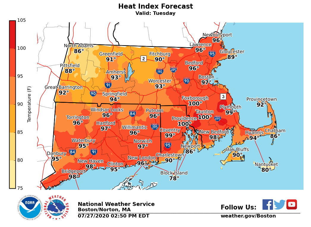
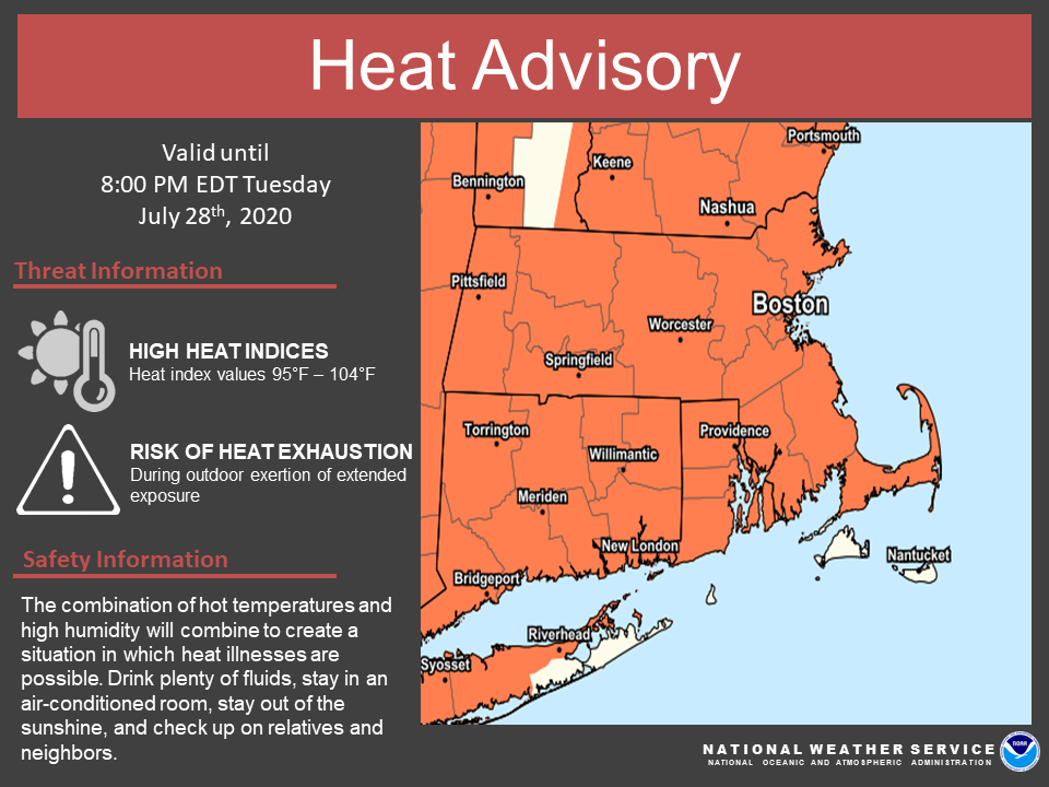
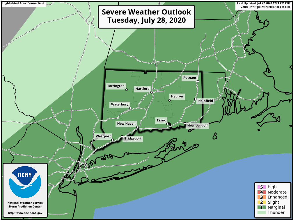
Good afternoon. Little has changed since this morning's briefing. Another day of dangerous heat is expected Tuesday along with isolated severe thunderstorms. *What: *Heat Advisory for heat indices of 95 to 104 *Where & When:* - Tuesday - All of southern New England except for the Berkshires, Franklin, western Hampshire and western Hampden counties, Nantucket, Martha's Vineyard, and Block Island. - The heat will be exacerbated by the duration of this event with record highs possible again Tuesday. In addition, record breaking warmth is possible tonight when minimum temperatures may only fall to 75 to 80 degrees in the urban centers including Boston and Hartford. Isolated severe thunderstorms are possible across southern New England on Tuesday as a cold front slides in. The time frame is from late morning into the afternoon. The main threats with any stronger storms are damaging winds and minor street flooding. Images attached include the heat index forecast for Tuesday, the severe weather outlook for Tuesday, and current Heat Advisories (note this is different than tomorrow). - Joe DelliCarpini and Bill Leatham If you have any questions or would like more information, don't hesitate to contact us via this email address, on NWSChat <https://nwschat.weather.gov/>, or at the following: National Weather Service Boston/Norton, MA 46 Commerce Way Norton, MA 02766 508.622.3280 Website <http://www.weather.gov/boston> | Facebook <http://www.facebook.com/NWSBoston> | Twitter <http://www.twitter.com/NWSBoston>