
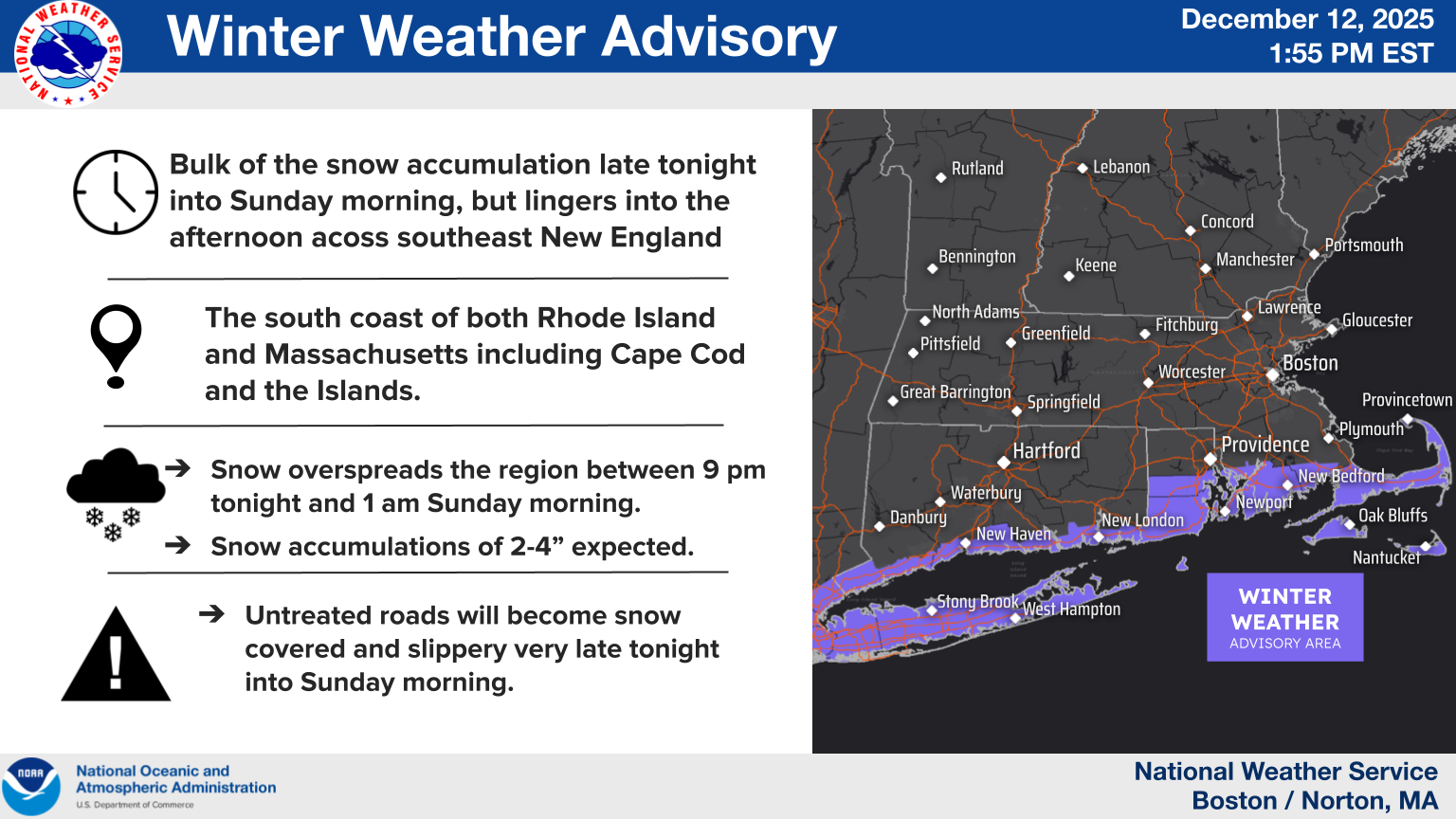
Good morning everyone... A Winter Weather Advisory has been issued for the south coast of both Rhode Island and Massachusetts including Cape Cod and Islands late tonight into Sunday. Otherwise, no real change to the prior forecast. We are still expecting a coating to 1" of snow north of the Massachusetts Turnpike, 1-3" south of the pike, and up to 4" near the south coast. There still is some uncertainty on the northern extent of the main snow shield. While these are lower probability outcomes...we still want to convey that a shift north would bring the potential for 1-2" of snow to near the New Hampshire border with 3-6" possible across Rhode Island and southeast Massachusetts. A southward shift would confine the 1-2" amounts to areas near the south coast with less elsewhere. We have attached a brief one-pager along with our latest snowfall forecast and a graphic indicating the location of the Winter Weather Advisory. Please let us know if you have any questions or concerns! Thank You! Meteorologist: Hayden Frank If you have any questions or would like more information, please don't hesitate to contact us. You can reach us via: email: box.operations@noaa.gov phone: 508.622.3280 Slack/NWSChat 2.0 <https://nwschatws.slack.com/> (for approved partners) social media: Website <http://www.weather.gov/boston> | Facebook <http://www.facebook.com/NWSBoston> | Twitter <http://www.twitter.com/NWSBoston>