
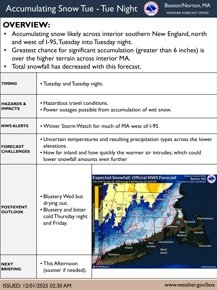
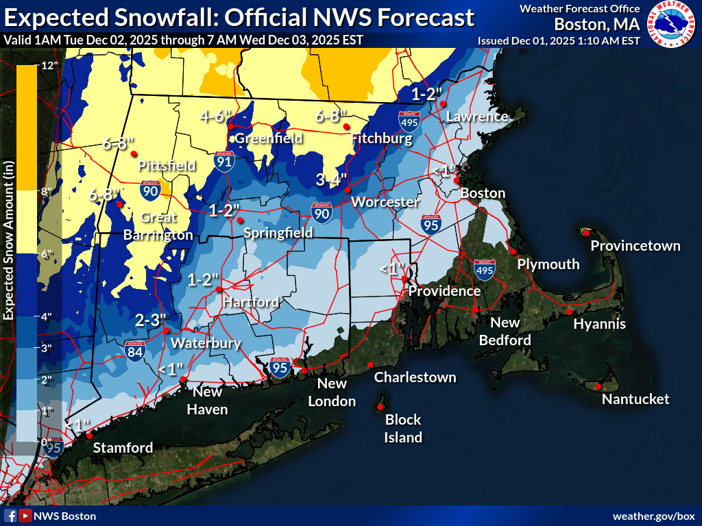
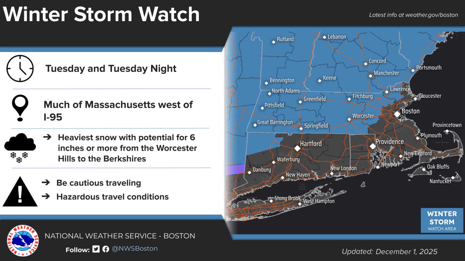
Good morning, Here is an updated one-page briefing for the potential winter storm to impact the region Tuesday into Tuesday night. - Winter Storm Watches continue for most of MA west of I-95 - *Overall snowfall forecast has decreased.* - Greatest risk for 6 or more inches of snowfall will be across the northern Worcester Hills and towards the Berkshires. Questions remain about how quickly and far warmer air can move across interior southern New England. A faster timing will mean less snowfall for more locations. The Tuesday morning commute may be able to end before the widespread snowfall arrives. Areas from Worcester County west in MA and across CT are most likely to see some impacts on the Tuesday morning commute. The next update will be this afternoon, but sooner if there are appreciable changes to the forecast. Meteorologists Matthew Belk and Bryce Williams If you have any questions or would like more information, please don't hesitate to contact us. You can reach us via: email: box.operations@noaa.gov phone: 508.622.3280 Slack/NWSChat 2.0 <https://nwschatws.slack.com/> (for approved partners) social media: Website <http://www.weather.gov/boston> | Facebook <http://www.facebook.com/NWSBoston> | Twitter <http://www.twitter.com/NWSBoston>