
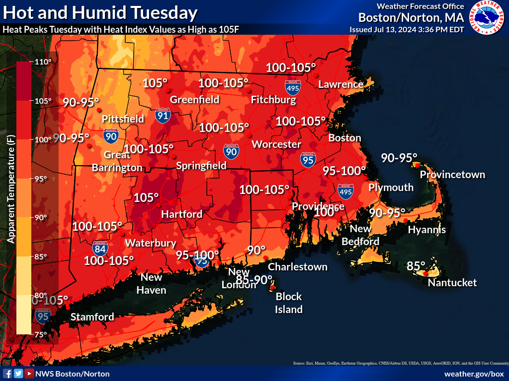
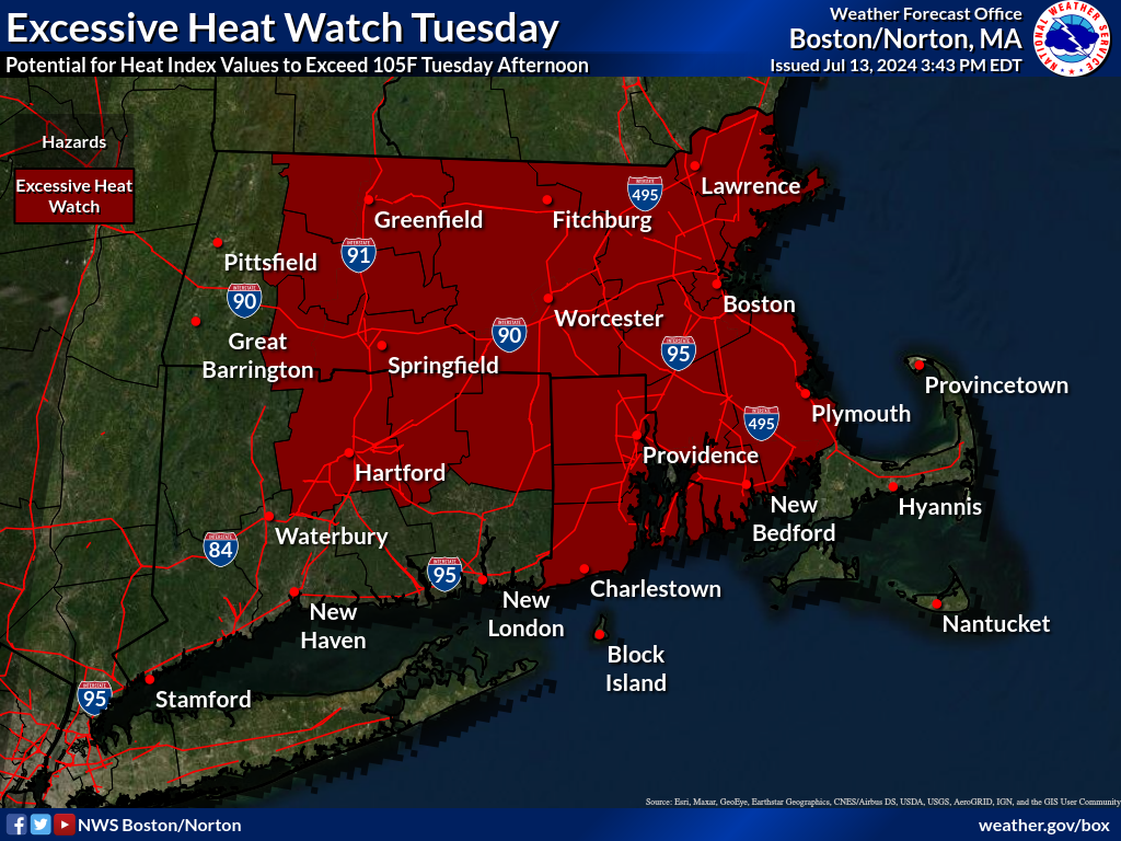
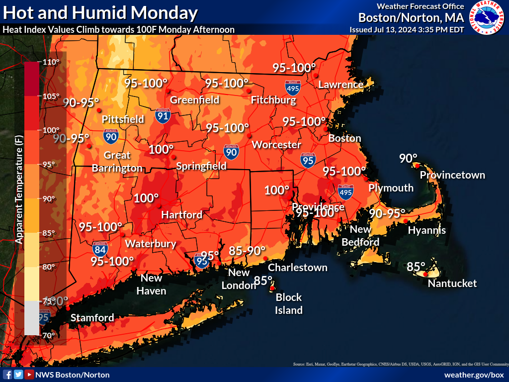
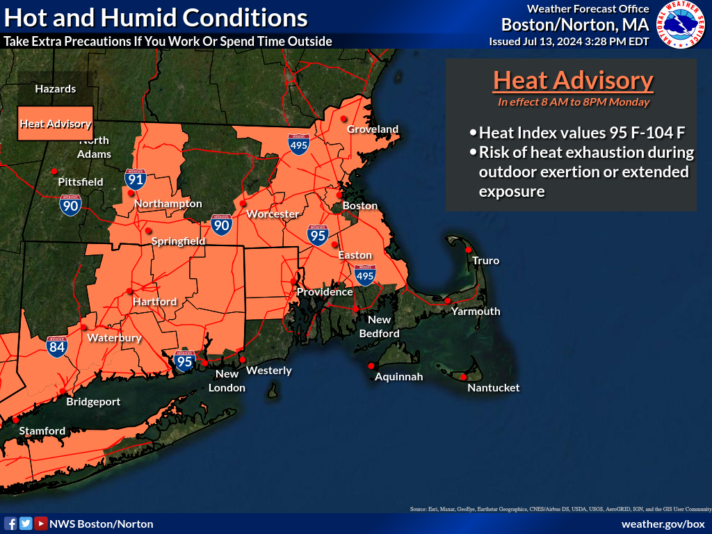
Good afternoon all, With the threat for localized flooding over and rain moving off the coast, our attention turns to the dangerous heat and humidity that will build into the region Monday. This heat is expected to peak on Tuesday, and may persist through Wednesday; though, we expect a cold front to swing through the region late Wednesday/Thursday which, depending on timing, could impact heat index values on Wednesday afternoon. On Monday, heat index values are expected to climb to between 95-100F across the region; excluding the immediate coastline and the high terrain of western and central Massachusetts. We have issued a Heat Advisory for much of the interior from 8 AM to 8 PM Monday. On Tuesday, heat index values have the potential to exceed 105F, particularly across the CT and Merrimack River Valleys and across MetroWest. Given this potential, we have issued an Excessive Heat Watch from 8AM to 8PM Tuesday, which does NOT include the Cape and Islands. This watch will be converted to either a heat advisory or excessive heat warning in future updates depending on forecast trends. On Wednesday, there is a high likelihood that heat index values will again exceed 95-100F if the cold front is delayed until the evening hours, thus, there will likely be heat headlines issued by later shifts to encompass Wednesday. Confidence in heat index values of 105F or greater on Wednesday was not high enough at this time to extend the Excessive Heat Watch. Kind regards, Matt Belk and Kristie Smith If you have any questions or would like more information, please don't hesitate to contact us. You can reach us via: email: box.operations@noaa.gov phone: 508.622.3280 Slack/NWSChat 2.0 <https://nwschatws.slack.com/> (for approved partners) social media: Website <http://www.weather.gov/boston> | Facebook <http://www.facebook.com/NWSBoston> | Twitter <http://www.twitter.com/NWSBoston>