
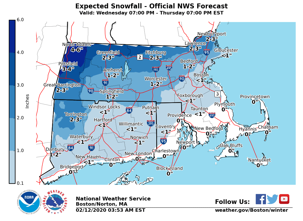
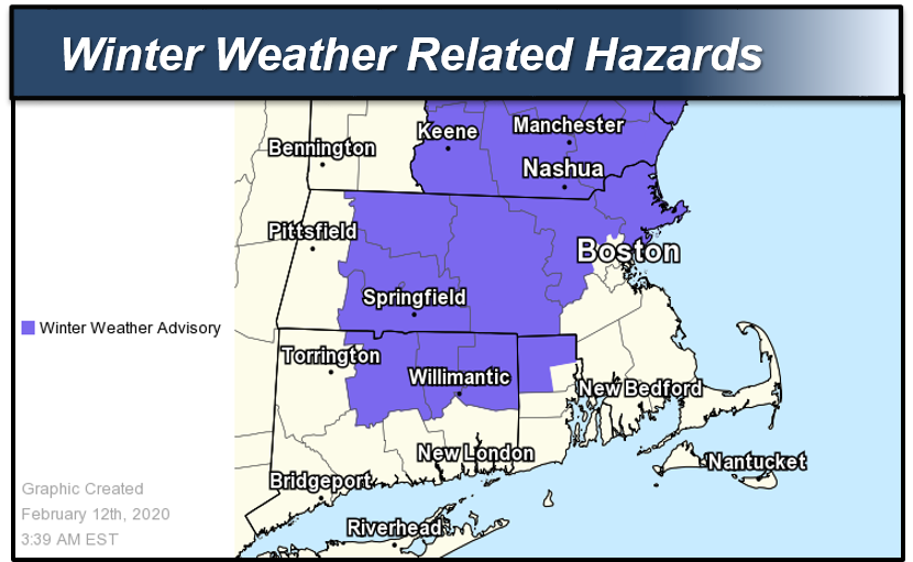
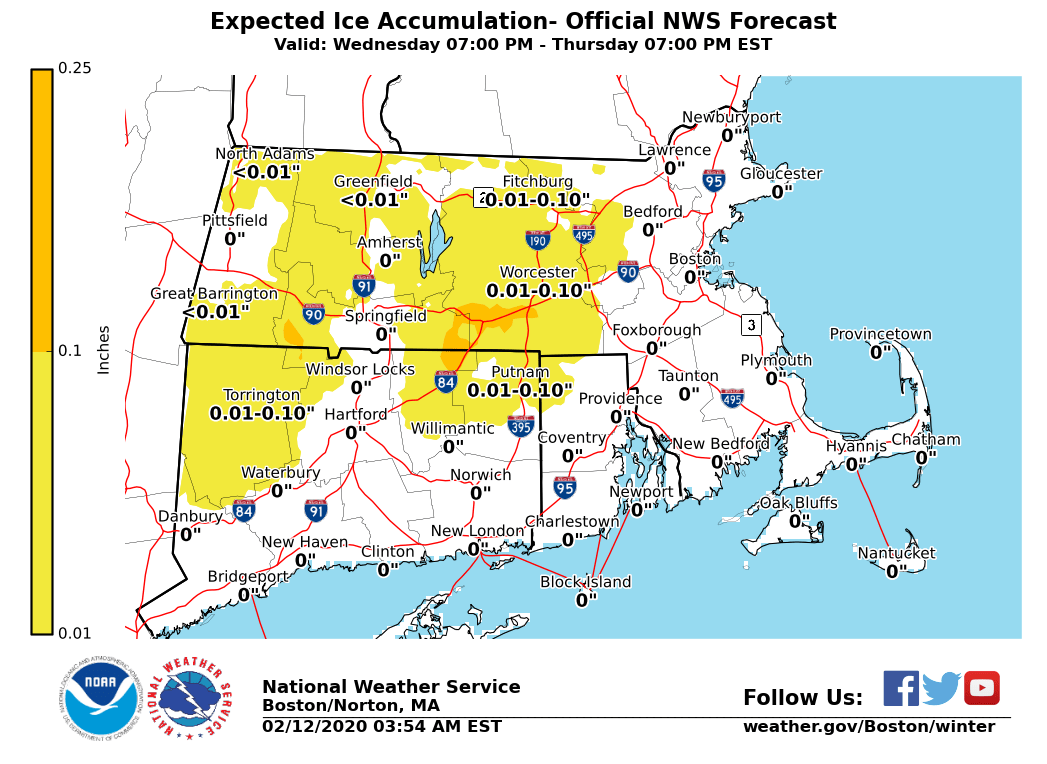
Good morning everyone, We continue to forecast a wintry mix that will impact parts of our region during part of the Thursday morning commute. This will not be a big storm, but given the timing there will be some impacts mainly northwest of a Boston to Providence to Hartford line. Not much has changed with our forecast for this storm, but a *Winter Weather Advisory* has been issued from *11 PM this evening through 9 am Thursday (continues through noon Thursday for northern Massachusetts).* *WHAT/WHERE:* - Ptype may begin as a brief period of snow/sleet near the Boston to Providence to Hartford corridor, but a quick change to rain should occur with any impact being rather limited. Any snow/sleet accums should be less than an inch. - Further northwest into the Hills of northern CT, as well as southwest and south central MA a coating to 2 inches of snow and sleet is expected. A period of light freezing rain may follow with up to one tenth of an inch of ice accretion possible mainly in the high terrain. - Greatest impact is expected across far northern MA, especially near the NH border where 2 to 4 inches of snow is possible with isolated 5 to 6 inch amounts not out of the question in extreme northwest MA. Light ice accretion up to one tenth of an inch may follow. *WHEN:* *-* Precipitation overspreads the region between 11 PM and 3 AM Thursday from west to east. Any snow/sleet will then change to rain near the Boston to Providence to Hartford corridor. - Further northwest the threat for accumulating snow will be through 6 or 7 AM Thursday, before precipitation changes to sleet,freezing rain and rain. Brief 1 inch per snowfall rates possible north of Route 2 in far northern MA through 7 AM Thursday. - Light ice accretion may follow through mid morning Thursday, mainly in the higher terrain with up to one tenth of an inch of ice accretion possible. Elsewhere, mainly rain is expected after 7 or 8 AM Thursday. - Ideally locations should have changed to rain by Thursday afternoon with temps above freezing, however there remains some uncertainty whether things will ever chance to rain along the New Hampshire border. *POTENTIAL IMPACTS:* *- *The main concern is northwest of the Boston to Providence to Hartford corridor, where a wintry mix will impact part of the Thursday AM commute. Any snow/sleet accums should be a coating to 2 inches, but some light ice accretion may follow especially in the high terrain. - Greatest risk for a plowable snowfall will be north of Route 2 in Massachusetts, where 2 to 4 inches of snow may accumulate and perhaps isolated 5 to 6 inch amounts in extreme northwest Massachusetts. -* The greatest impacts will likely be across far northern Massachusetts where a plowable is possible. A brief period of 1 inch per hour snowfall rates is possible during part of the Thursday morning commute.* Please let us know if you have any questions or concerns! Thank You Meteorologist: Bryce Williams If you have any questions or would like more information, don't hesitate to contact us via this email address, on NWSChat <https://nwschat.weather.gov/>, or at the following: National Weather Service Boston/Norton, MA 46 Commerce Way Norton, MA 02766 508.622.3280 Website <http://www.weather.gov/boston> | Facebook <http://www.facebook.com/NWSBoston> | Twitter <http://www.twitter.com/NWSBoston>