
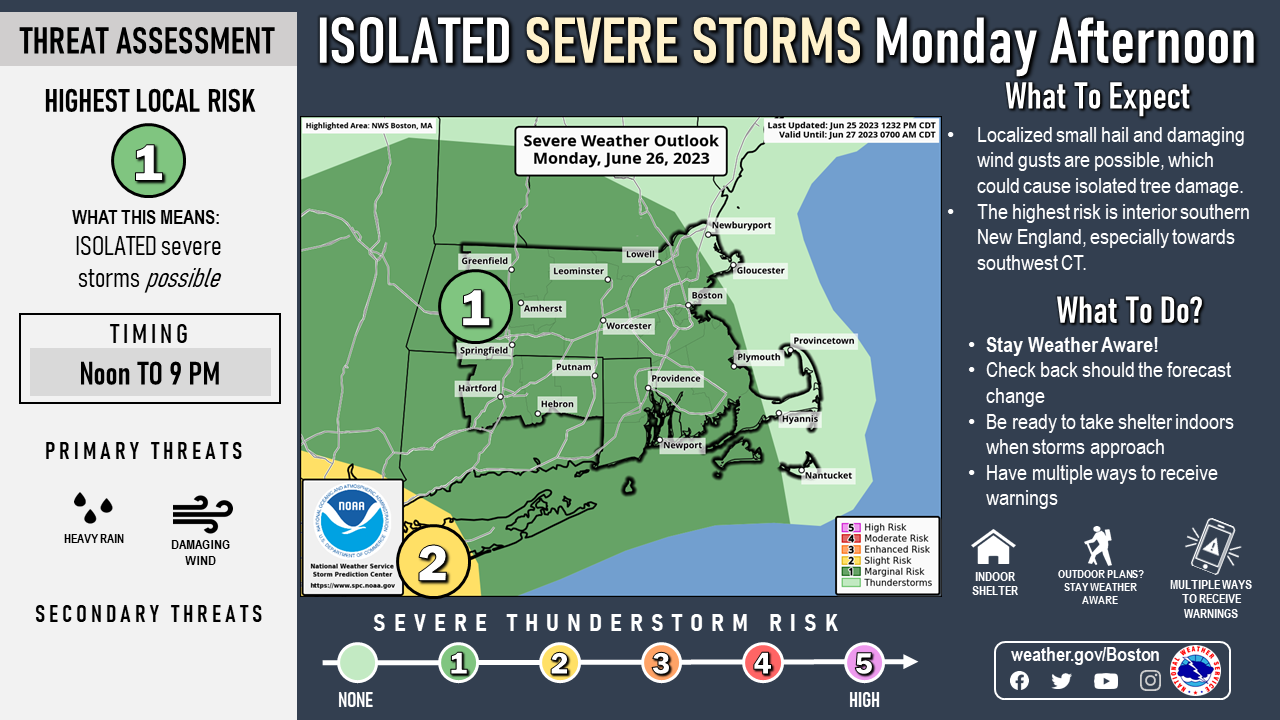
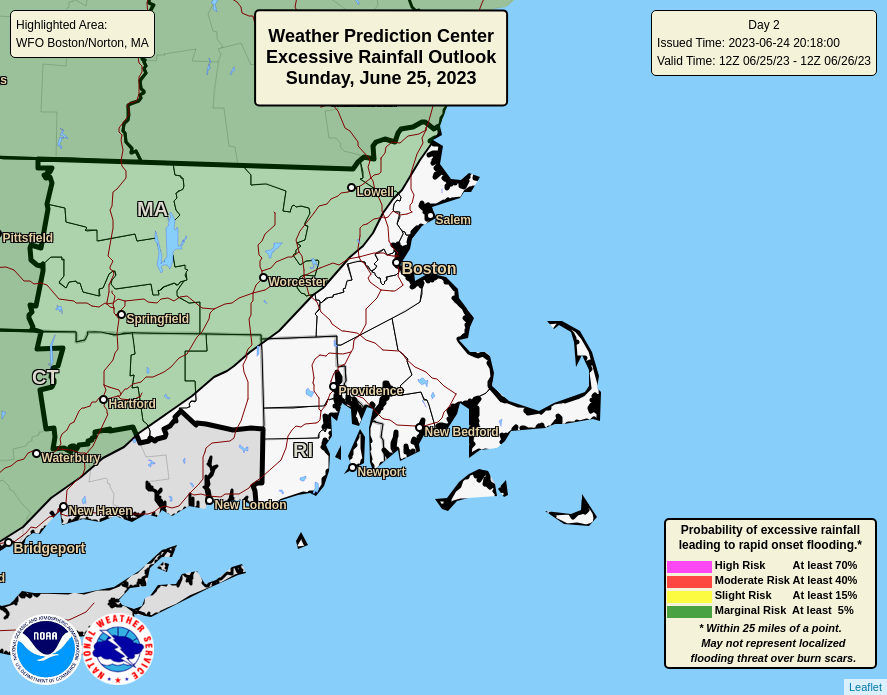
Good afternoon, There is a risk for mainly afternoon showers and thunderstorms just about all of this week. Some days may feature stronger thunderstorms than others. Monday will be one of those days. The greatest risk should remain mainly to the southwest of most of southern New England tomorrow. The main threats will be locally strong to damaging winds, possibly resulting in localized tree and powerline damage, as well as downpours leading to localized flooding. Urban areas will be most at risk for the flooding, mainly due to poor drainage. The attached images will highlight the areas for both of these threats. Meteorologists Matthew Belk and Bryce Williams If you have any questions or would like more information, don't hesitate to contact us via this email address, on NWSChat <https://nwschat.weather.gov/>, or at the following: National Weather Service Boston/Norton, MA 46 Commerce Way Norton, MA 02766 508.622.3280 Website <http://www.weather.gov/boston> | Facebook <http://www.facebook.com/NWSBoston> | Twitter <http://www.twitter.com/NWSBoston>