
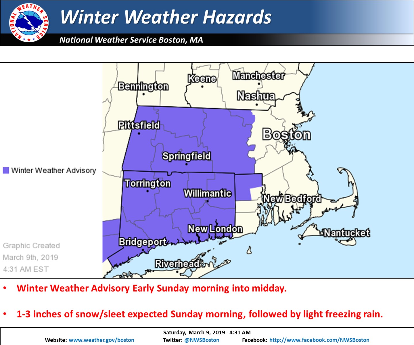
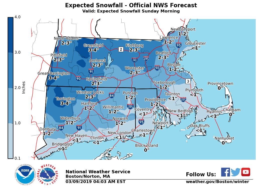
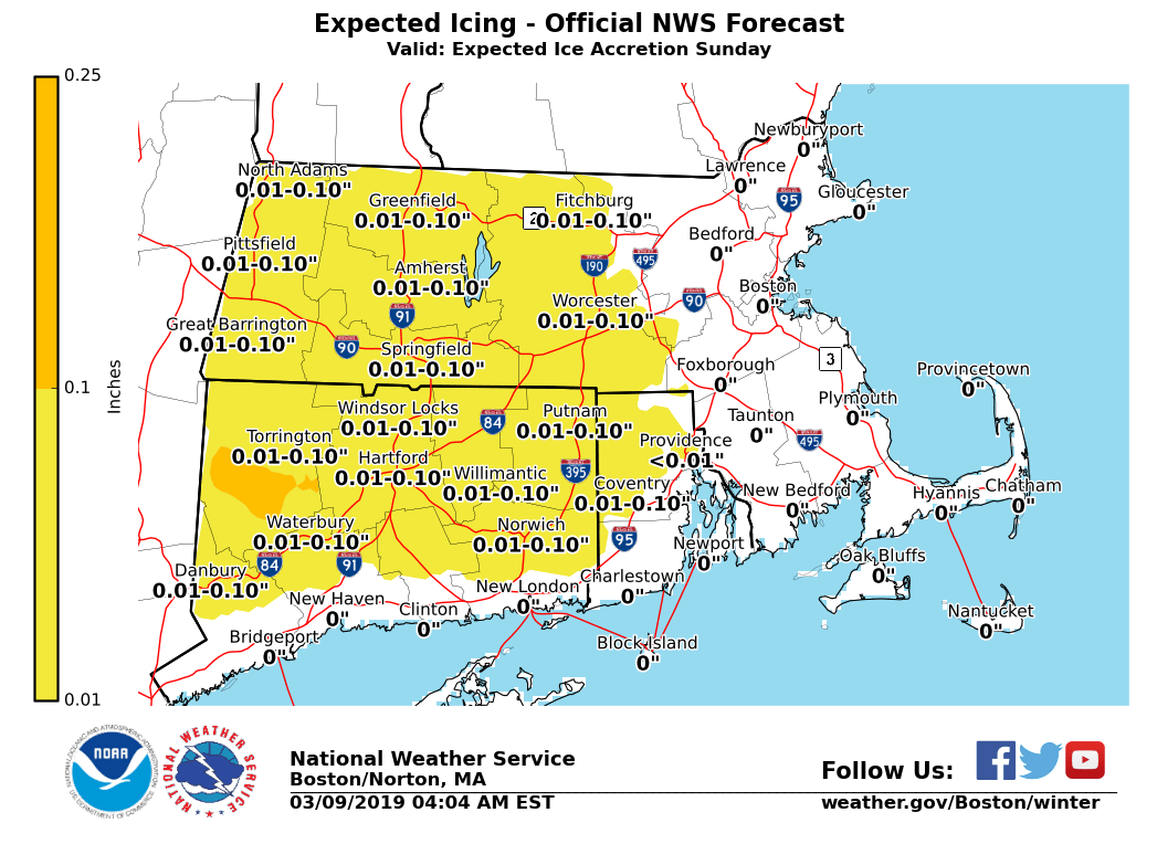
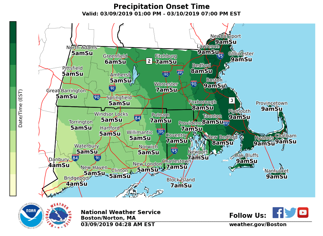
Good morning everyone A Winter Weather Advisory has been posted for western and central MA, as well as northern CT and into northwest RI early Sunday morning into midday. This is for 1 to 3 inches of snow and sleet followed by a brief period of light icing. The expected onset time of the snow/sleet, along with the latest snowfall and ice accretion forecasts have been attached to this email. *WHAT/WHERE: * - 1 to 3 inches of snow and sleet expected near and northwest of the Boston to Providence corridor. Greatest risk for the higher snow amounts will be in western MA. - A period of light freezing rain anticipated across interior MA/CT and into northwest RI. Ice accretion amounts will be light, generally a trace to no more than a tenth of an inch. *WHEN:* - Snow and sleet develop from west to east between 5 and 9 am Sunday morning. A brief burst of heavy snow is possible which may result in roads quickly becoming snow covered, especially in western/central MA into northern CT. - Precipitation will change to rain by Sunday afternoon along and southeast of the Boston to Providence corridor. Northwest of that region, a period of light freezing rain is expected which should gradually change to all rain by mid afternoon. *IMPACTS:* - Roads may quickly become snow covered Sunday morning with a brief burst of moderate to heavy snow possible. This may also result in a period of poor visibility. - Conditions should improve in most locations by early Sunday afternoon, but some icy spots may remain possible across the highest terrain of MA *UNCERTAINTY:* *- *Our current forecast calls for 1 to 3 inches of snow near and northwest of the Boston to Providence corridor with the highest amounts likely in western MA. *- *If the change from snow to sleet is delayed, many locations may receive 2 to 4 inches of snow. However, if the change to sleet is earlier then expected most areas will receive an inch or less of accumulations. - Regardless, snow and sleet will result in slippery travel Sunday morning along with with reduced visibility. Please let us know if you have any questions or concerns. Thank You Meteorologist: Hayden Frank If you have any questions or would like more information, don't hesitate to contact us via this email address, on NWSChat <https://nwschat.weather.gov/>, or at the following: National Weather Service Boston/Norton, MA 46 Commerce Way Norton, MA 02766 508.622.3280 Website <http://www.weather.gov/boston> | Facebook <http://www.facebook.com/NWSBoston> | Twitter <http://www.twitter.com/NWSBoston>