
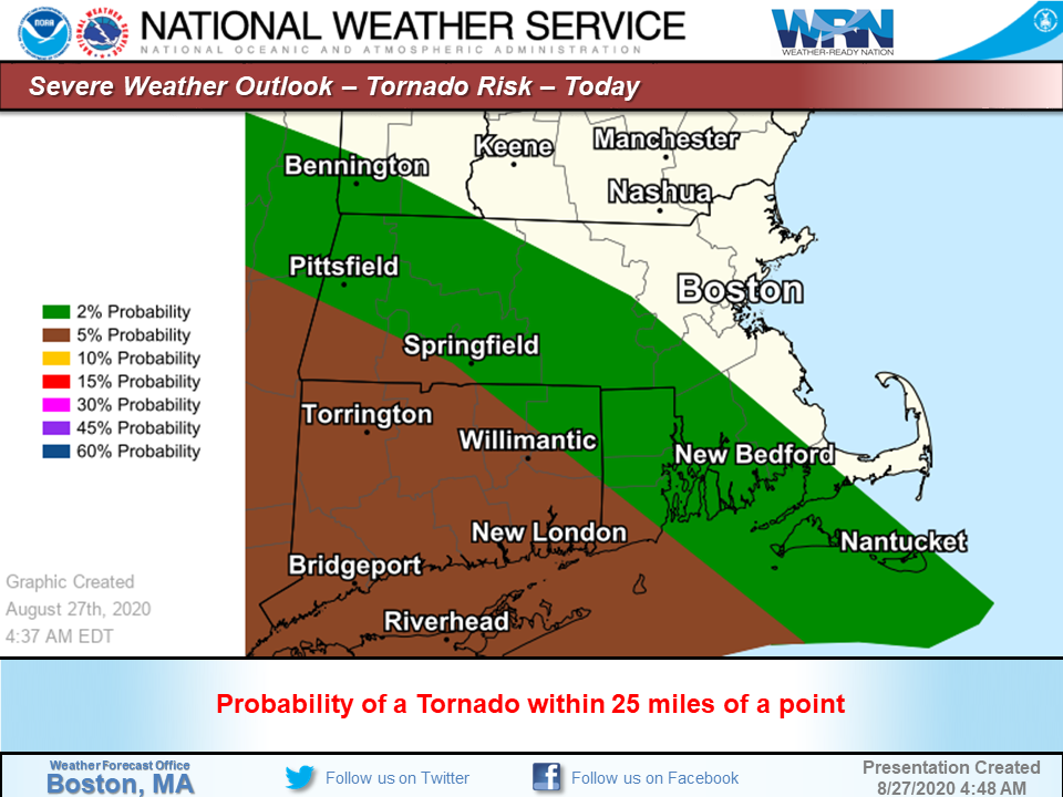
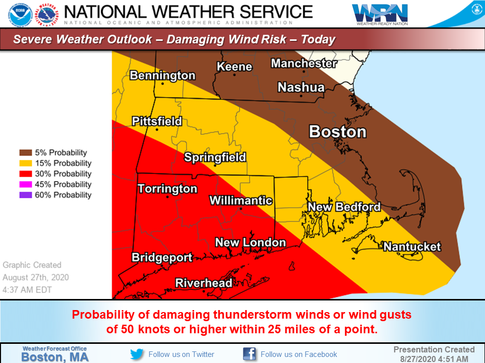
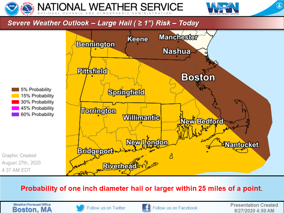
Good morning everyone, This afternoon and early evening there is the risk for strong to severe thunderstorms across portions of southern New England. Here are the details... *What ... *potential scattered strong to severe thunderstorms with damaging winds, large hail and a low probability of an isolated tornado *Where ... *greatest threat is across Connecticut with lower probabilities into MA and RI *When ... *approximately 3 pm to 9 pm *Forecast Confidence ... *there is uncertainty on how far north the threat of severe weather exists. As of now it appears the greatest risk is across the state of Connecticut, however strong to severe storms may spill into southwest Massachusetts including the Greater Springfield area and eastward into southwest RI, including the Westerly area. Conversely, cool air over northern MA may shift the threat of severe weather farther south and spare much of southern New England. Stay tuned to later forecasts for updated trends. This email will be updated one more time later this morning or early afternoon. Attached are four graphics highlighting the threat areas for damaging winds, large hail and tornadoes. Frank Nocera & Kevin Cadima If you have any questions or would like more information, don't hesitate to contact us via this email address, on NWSChat <https://nwschat.weather.gov/>, or at the following: National Weather Service Boston/Norton, MA 46 Commerce Way Norton, MA 02766 508.622.3280 Website <http://www.weather.gov/boston> | Facebook <http://www.facebook.com/NWSBoston> | Twitter <http://www.twitter.com/NWSBoston>