
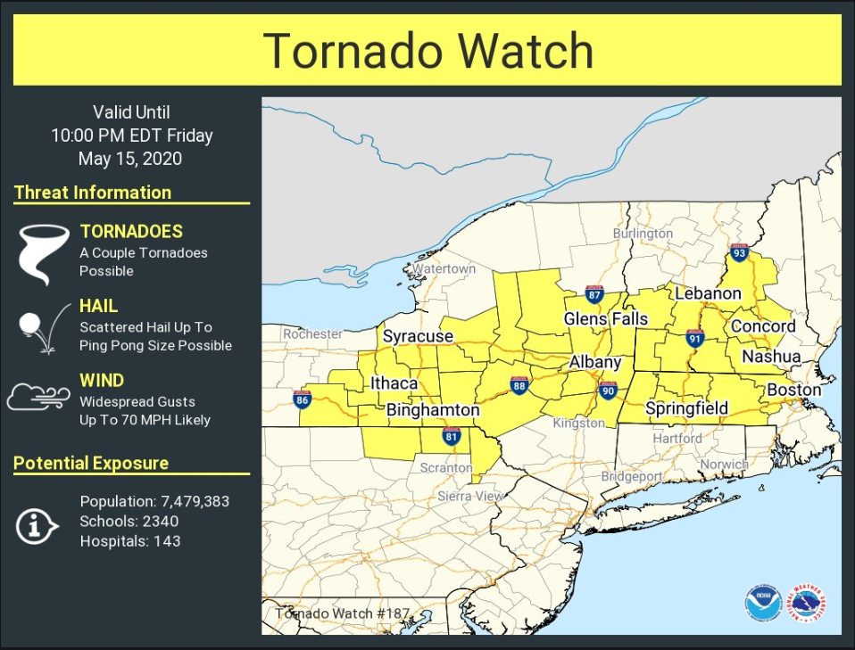
Good afternoon, A Tornado Watch has been issued for all of western, central and portions of eastern Massachusetts until 10 PM tonight. Still expecting a line of storms to move in after 7 PM, but there is a threat for a few isolated storms ahead of the line before 7 PM. *Threats:* *Main threat: Damaging wind gusts up to 70 mph* In addition: Few tornadoes possible Large hail up to ping pong ball sized possible Dangerous cloud to ground lightning Heavy rain may lead to street flooding *Timing and Threat Area:* 3-7PM: A few Isolated storms possible anywhere 7-10 PM: western, central and northeast Massachusetts Thank you, If you have any questions or would like more information, don't hesitate to contact us via this email address, on NWSChat <https://nwschat.weather.gov/>, or at the following: National Weather Service Boston/Norton, MA 46 Commerce Way Norton, MA 02766 508.622.3280 Website <http://www.weather.gov/boston> | Facebook <http://www.facebook.com/NWSBoston> | Twitter <http://www.twitter.com/NWSBoston>