
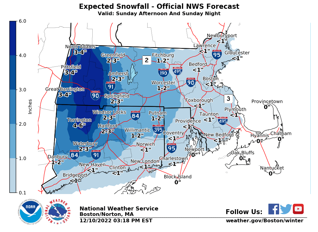
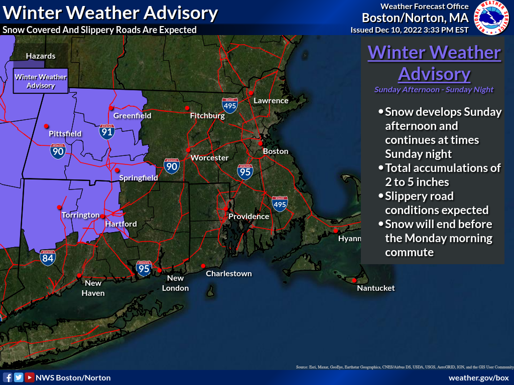
Good afternoon everyone, Winter Weather Advisories have been issued for Western Massachusetts and Western Connecticut Sunday afternoon & Sunday night. 2 to 5 inches of snow are anticipated for this region with the greatest risk for the higher amounts in the Berkshires. Snow is expected to develop Sunday afternoon and continue at times Sunday night. The snow is expected to end before the Monday morning commute, but untreated roads will remain snow covered and slippery across much of interior Massachusetts and Connecticut. The biggest uncertainty remains how far east the accumulating snow will reach. This will determine whether parts of Central Massachusetts and Rhode Island receive a few inches of snow or less than an inch. Please find our updated one-page briefing attached, as well as our most recent snow accumulation forecast along with the map of the Winter Weather Advisory. Thank You! Meteorologists: Hayden Frank and Rob Megnia If you have any questions or would like more information, don't hesitate to contact us via this email address, on NWSChat <https://nwschat.weather.gov/>, or at the following: National Weather Service Boston/Norton, MA 46 Commerce Way Norton, MA 02766 508.622.3280 Website <http://www.weather.gov/boston> | Facebook <http://www.facebook.com/NWSBoston> | Twitter <http://www.twitter.com/NWSBoston>