
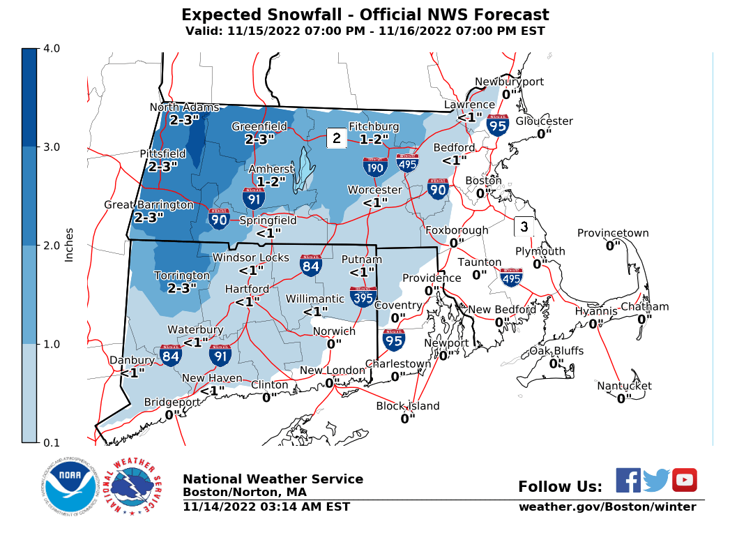
Good Morning, The first accumulating snow of the season for portions of interior southern New England is expected Tuesday night into Wednesday morning. Please find our one-page briefing regarding the event attached. We would like to emphasize that this will be a relatively low impact event restricted to the high terrain north and west of the Worcester area, with NO IMPACTS expected along the I-95 corridor. A few novelty flakes may fly across metro-West and the Hartford metropolitan area. Barring any major changes, the next update is expected by 6 AM Tuesday morning. Kind Regards, Kristie Smith and Frank Nocera If you have any questions or would like more information, don't hesitate to contact us via this email address, on NWSChat <https://nwschat.weather.gov/>, or at the following: National Weather Service Boston/Norton, MA 46 Commerce Way Norton, MA 02766 508.622.3280 Website <http://www.weather.gov/boston> | Facebook <http://www.facebook.com/NWSBoston> | Twitter <http://www.twitter.com/NWSBoston>