
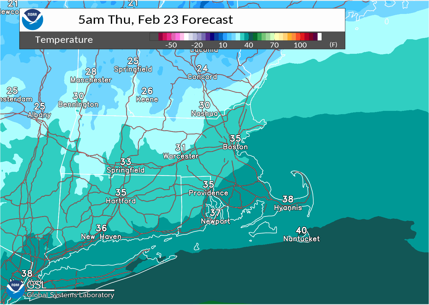
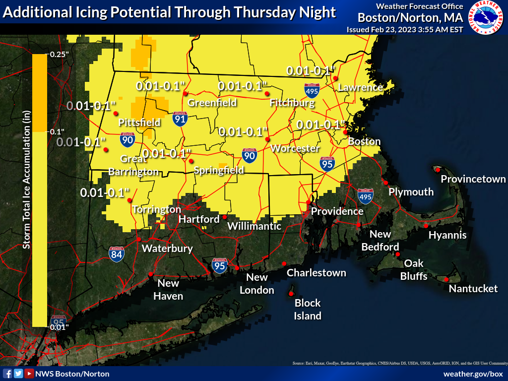
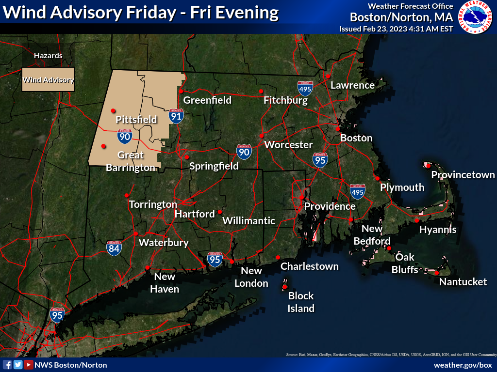
Good morning, Changes with this forecast update include - - A wind advisory for western MA, including the Berkshires - NW winds Friday with gusts up to 50 mph, combined with possible ice covered trees, will increase the risk for potential power outages (see attached Wind Advisory map) Otherwise, winter weather advisories remain posted through Thursday night for all of MA, RI & CT, except southern portions of RI and MA, where temperatures will remain above freezing. A wintry mix of precipitation across northern MA Thursday morning, with all rain in CT, RI and southeast MA, will taper off to drizzle later this morning and eventually areas of freezing drizzle this afternoon, as temperatures drop below freezing. This will also result in a flash freeze this afternoon and evening, as any standing water or slush freezes, yielding icy travel, especially on untreated roadways and surfaces. Another round of a wintry mix is expected later this evening and overnight, finally giving way to dry weather Friday. Attached is a loop showing hourly temperatures dropping this afternoon and evening. Also, a graphic is included showing the potential for additional icing through tonight. Torry Gaucher and Frank Nocera If you have any questions or would like more information, don't hesitate to contact us via this email address, on NWSChat <https://nwschat.weather.gov/>, or at the following: National Weather Service Boston/Norton, MA 46 Commerce Way Norton, MA 02766 508.622.3280 Website <http://www.weather.gov/boston> | Facebook <http://www.facebook.com/NWSBoston> | Twitter <http://www.twitter.com/NWSBoston>